
What is recorded here
From the National Monuments Service (Archaeological Survey of Ireland) record DG036-013
Places near here
Photo credits
- Maker not stated on source page, www.youtube.com
- Maker not stated on source page, archaeology.org
- National Inventory of Architectural Heritage
- Maker not stated on source page, au.pinterest.com
- Kenneth Allen, Geograph · CC BY-SA 2.0
- Maker not stated on source page, en.wikipedia.org
- Proinsias Carr / Donegal GAA, donegalgaa.ie
- Maker not stated on source page, www.dreamstime.com
- Maker not stated on source page, www.ireland.com
 Megalithic structure in GarrygortMegalithic structure · 1332 yd
Explorer Tom Megalithic structure in Garrygort is basically two rude stone slabs that are constantly arguing about which one looks…
 Megalithic tomb in AghanursanMegalithic tomb · 1444 yd
Explorer Tom Megalithic tomb in Aghanursan was once spotted on the western side of Columbkille Lough, but now it’s vanished into the…
 graveyard/cemetery1627 yd
Explorer Tom Graveyard or cemetery in Glenkeen keeps its secrets tucked behind those rough-cut stones. Restored in 2006, it holds…
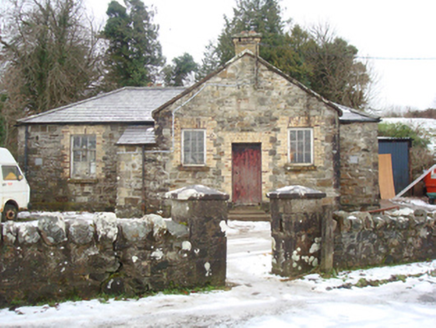 school1.3 mi
Explorer Tom School in Fogher was a 'Male' school back in 1872, which means the girls probably had their own secret base just down…
 Court tomb in LoughnakeyCourt tomb · 1.3 mi
Explorer Tom The Court tomb in Loughnakey is such an oddball that it didn’t make it onto any maps. Its west side is completely gone…
 St. Peter's Catholic ChurchChurch/chapel · 1.4 mi
Explorer Tom St. Peter's Catholic Church has a rooster on top that probably thinks it is in charge of the whole town. I bet every…
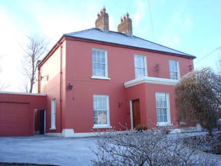 Lake ViewHouse · 1.4 mi
Explorer Tom Lake View was built around 1860 and might have been a surgery, which means someone probably had a very bad day waiting…
 The Traveller's InnRestaurant · 1.5 mi
Explorer Tom The Traveller's Inn at Kilmacrennan Road junction might be hiding a map in the sauce. I bet the chef knows where the…
 Mapped cemeteryCemetery · 1.6 mi
Explorer Tom Mapped cemetery handles nosy neighbours by pretending not to hear them, which is an ancient skill that takes decades of…
 Moyle View Park, Milford GAAGAA ground · 1.7 mi
 Mapped graveyardGraveyard · 1.7 mi
Explorer Tom This unnamed graveyard in County Donegal had a massive falling out with the next village over who stole their windmill…
 Hewitson's IslandIslet · 2.1 mi
Explorer Tom Hewitson's Island in County Donegal would say in a job interview that it has great stability and zero maintenance…
More archaeology and monuments in County Donegal · All of County Donegal

What do you know about this place?Tap to add a comment or ask a question