
What is recorded here
From the National Monuments Service (Archaeological Survey of Ireland) record DG062-011
Places near here
Photo credits
- National Inventory of Architectural Heritage
- Maker not stated on source page, www.vecteezy.com
- Maker not stated on source page, ca.pinterest.com
- Maker not stated on source page, blog.adafruit.com
- Richard Webb, Wikimedia Commons · CC BY-SA 2.0
- Kenneth Allen, Geograph · CC BY-SA 2.0
- Maker not stated on source page, ru.pinterest.com
 bridge619 yd
Explorer Tom Bridge in Carricknamart has that chunky V-shaped stone wedge jutting out into the water. I bet it’s there to stop the…
 outbuilding1506 yd
Explorer Tom Outbuilding in Mondooey Lower has a carriage arch and an iron-bar gate. It looks like a checkpoint for carts with…
 house, outbuilding1530 yd
Explorer Tom House, Outbuilding in Roosky is a distinctive mix of home and workspace under one roofline. It’s got battened timber…
 Man-made underground passage in Roosky (castleforward Ed)Man-made underground passage · 1580 yd
Explorer Tom Man-made underground passage in Roosky sounds like a secret hallway that someone forgot to close when they left. I…
 Stone row in LabbadishStone row · 1.0 mi
Explorer Tom Stone row in Labbadish has a proper standing stone right in the middle, but the two next to it are just granite…
 railway station1.2 mi
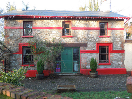
Explorer Tom Railway station in Drumcarn is secretly proud of the potato it once carried to market. It thinks it’s a celebrity now…
 worker's house1.2 mi
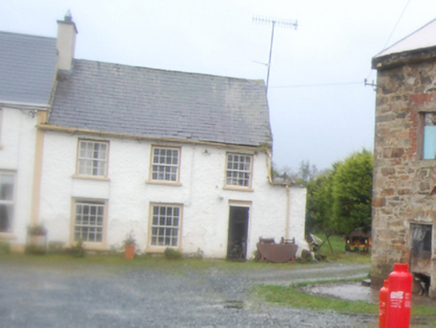
Explorer Tom Worker's house in Corkey, built around 1825, stands near a former corn mill and what may have been a flax mill. The…
 Green CottageOutbuilding · 1.2 mi
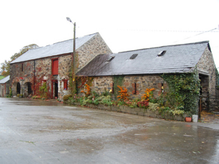
Explorer Tom Green Cottage might have been the ancestral home of John Caldwell Calhoun! He became the seventh Vice President of the…
 Standing stone in Droim EochailleStanding stone · 1.3 mi
Explorer Tom Standing stone in Droim Eochaille is only about a meter tall but nearly two meters wide, which makes it look like a…
 Battlefield in Tully (kincraigy Ed),glenmaquin Lower,roosky (castleforward Ed)Battlefield · 1.4 mi
Explorer Tom Tully, Glenmaquin Lower had a fox that took charge of the whole operation once, probably because it was smarter than…
 Mongorry HillMountain / peak · 1.8 mi
Explorer Tom Mongorry Hill swears by a superstition that says if you sneeze, you must buy a pint or it will rain all week. Locals…
 Raymoghy Old Church GraveyardGraveyard · 1.9 mi
Explorer Tom Rymoghy Old Church Graveyard keeps its history in the gate. Three medieval window fragments are built right into the…
More archaeology and monuments in County Donegal · All of County Donegal

What do you know about this place?Tap to add a comment or ask a question