
Places near here
Photo credits
- Ardfern, wikimedia
- Mike Searle, Geograph · CC BY-SA 2.0
- National Inventory of Architectural Heritage
- Killala GAA Club, via Connaught Telegraph; individual photographer not named, www.con-telegraph.ie
- N Chadwick, Geograph · CC BY-SA 2.0
- Bob Embleton, Wikimedia Commons · CC BY-SA 2.0
- Colin Park, Geograph · CC BY-SA 2.0
- Ireland’s National Parks project; photographer not stated, Ireland’s National Parks project
 Lacken, Lacken Sarsfields GAAGAA ground · 1257 yd
 CastleCastle, unclassified · 1.6 mi
Explorer Tom A love story went terribly wrong next to Castlelackan Demesne; she left him for a man with better hair and no history.…
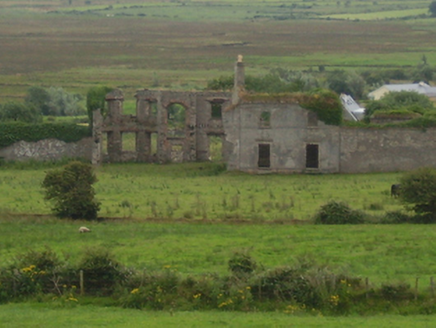 CastlelackanCountry house · 1.6 mi
Explorer Tom Castlilackan is just the remains of a fancy house, so it’s basically a skeleton showing off its bones. The shortcut…
 Lackan Church (Lackan)Church/chapel · 1.8 mi
Explorer Tom Lackan Church in Killogeary is stuck in a feud over who gets the best view of the field. It’s got that grey stone look…
 Carrowmore HouseGates/railings/walls · 2.0 mi
Explorer Tom Carrowmore House’s gateway is making a big deal about itself at the entrance to the estate, probably thinking it’s much…
 Heathfield HouseWalled garden · 4.3 mi
Explorer Tom Heathfield House walled garden in Gortatoor thinks the local sheep are too critical of its layout. They say it lacks…
 Gerry Maheady Memorial Park, Killala GAAGAA ground · 4.9 mi
 Farmhill HouseWalled garden · 6.1 mi
Explorer Tom Farmhill House is just a walled garden now because the house got demolished in 1950. Harriet Gardiner lived there, and…
 Ww2 Éire MarkerHeritage attraction · 6.1 mi
Explorer Tom WW2 Éire Marker: This marker looks like it’s got an imaginary twin across the Atlantic, just waiting for a phone call…
 Downpatrick HeadHeadland · 6.2 mi
Explorer Tom Downpatrick Head claims it’s older than the concept of time itself, which is a bold move for a headland that just looks…
 KnockaffertaghMountain / peak · 22 mi
Explorer Tom Knockaffertagh’s least favourite visitor is definitely anyone who suggests taking a selfie on top because it ruins the…
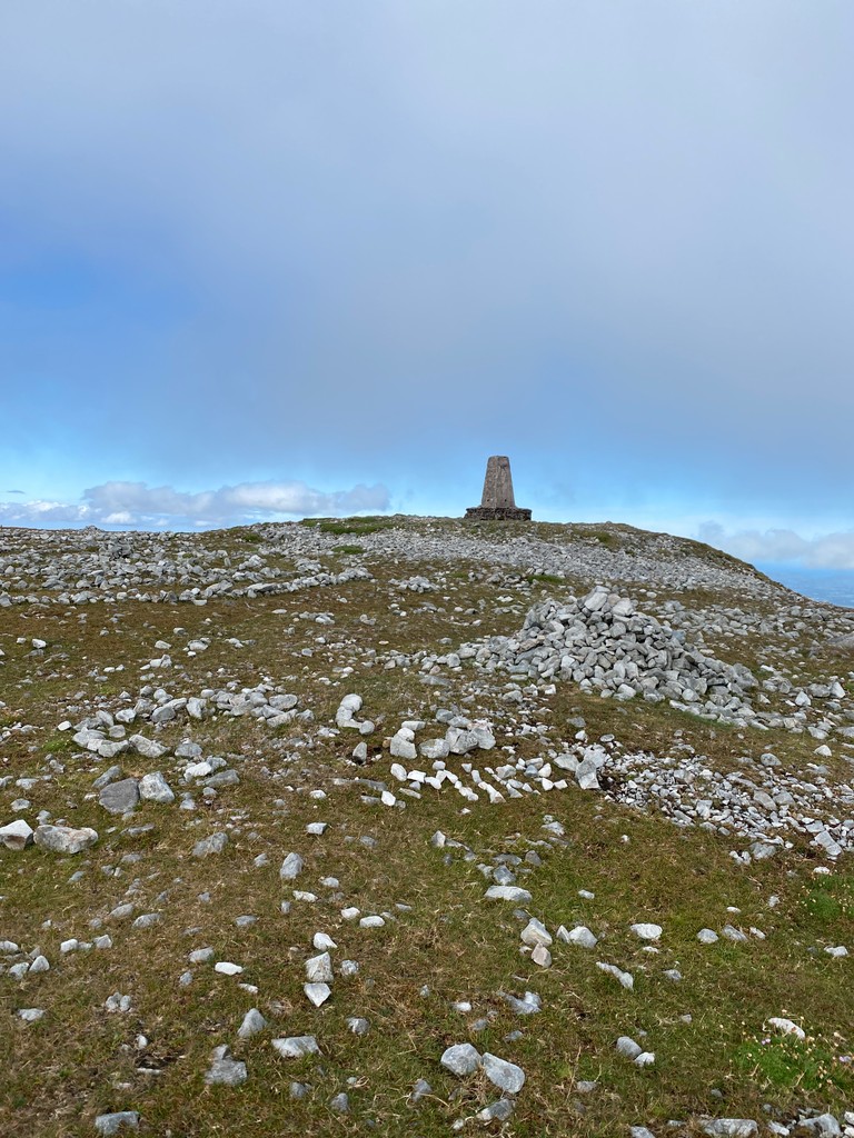 Slieve CarrMountain / peak · 22 mi
Explorer Tom Slieve Carr sits deep in County Mayo's Wild Nephin country, where mountains go looking for quiet. At 721 metres it is…
More archaeology and monuments in County Mayo · All of County Mayo

What do you know about this place?Tap to add a comment or ask a question