
What is recorded here
From the National Monuments Service (Archaeological Survey of Ireland) record CO150-068
Places near here
Photo credits
- Maker not stated on source page, www.tripadvisor.co.uk
- National Inventory of Architectural Heritage
- Maker not stated on source page, www.dreamstime.com
- Garry Dickinson, Geograph · CC BY-SA 2.0
- Maker not stated on source page, www.outinthenature.com
- Maker not stated on source page, www.tothe92.co.uk
- Maker not stated on source page, www.thenorthernantiquarian.org
- E.G. Irving, Wikimedia Commons · Public domain
- Colin Park, Geograph · CC BY-SA 2.0
- Mick Garratt, Geograph · CC BY-SA 2.0
- Martin Southwood, Geograph · CC BY-SA 2.0
 CastleCastle, unclassified · 186 yd
Explorer Tom Castle in Ballymacrown is the ultimate ghost story. An 18th-century document mentions 'Bally-Mac-Rowan', but nobody…
 Rathmore BridgeBridge · 1483 yd
Explorer Tom Rathmore Bridge is showing off its craftsmanship like it just got a new haircut. It’s all about those high-quality…
 Fairy fort / earthen ringfort in Rathmore (carbery West (e.d) By.)Fairy fort / earthen ringfort · 1.0 mi
Explorer Tom Fairy fort / earthen ringfort in Rathmore By.) gave up chocolate for Lent because it thought it was too sweet for its…
 Ballylinchey Signal TowerSignal tower · 1.2 mi
Explorer Tom Ballylinchey Signal Tower in Ballylinchy has been watching for French invaders since 1805. Still no sign of them, but…
 Cupmarked stone in KnockanoultyCupmarked stone · 1.2 mi
Explorer Tom Cupmarked stone in Knockanoulty had a single cupmark and two groupings, but now it’s gone missing entirely. It probably…
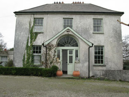 Glebe HouseRectory/glebe/vicarage/curate's house · 1.2 mi
Explorer Tom Glebe House in Baltimore is where the clergy kept their secrets and their classical doorcase. The local sheep probably…
 Rath, Baltimore, Ilen RoversGAA ground · 1.3 mi
 Cupmarked stone in Barnabah,knockanoultyCupmarked stone · 1.3 mi
Explorer Tom Cupmarked stone in Barnabah, Knockanoulty is watching from a hilltop because the local ghost is too lazy to actually…
 Kedge IslandIslet · 1.6 mi
Explorer Tom Kedge Island in County Cork would be the guest at a party who stands in the corner drinking tea and judging everyone…
 Castle (in Ruins)House, fortified house · 1.7 mi
Explorer Tom Castle in Baltimore is a rectangular house on a rocky prominence overlooking the harbour. It has ogee-headed lights…
 KnockomaghMountain / peak · 1.8 mi
Explorer Tom Knockomagh thinks tourists from Dublin are all wind and no substance, so keep your voice down near the summit. It’s got…
 Bullock IslandIslet · 1.9 mi
Explorer Tom Bullock Island holds a fake world record for being the most ignored islet in County Cork, which is honestly a bit…
More archaeology and monuments in County Cork · All of County Cork

What do you know about this place?Tap to add a comment or ask a question