DDiscover AloneMapAbout

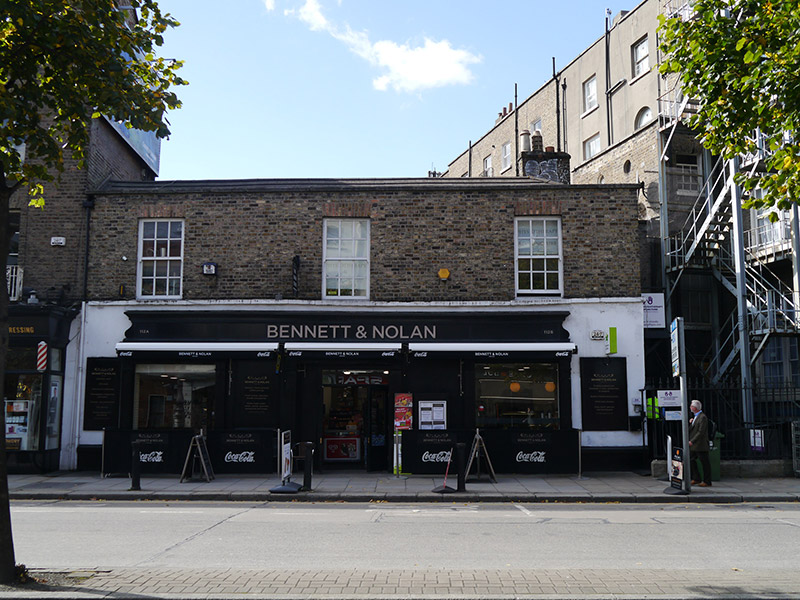
Stables in Baggot Street Lower

Stables
Stables in Baggot Street Lower
Photo: National Inventory of Architectural Heritage · Report the wrong picture

This does not grant access. Most recorded buildings are privately owned; view them only from public ground unless the owner allows entry.

Recorded change of use
Originally stables; recorded by the architectural inventory as shop/retail outlet
What do you know about this place?Tap to add a comment or ask a question

What you write will be public.

What is recorded here

Attached three-bay two-storey over basement former stables, built c. 1800, with two-storey flat-roofed return abutting to rear (south-west) and extending north. Now in commercial use. Pitched concrete-tiled roof, hipped to north-west, brick chimneystack with cornice and replacement clay pots to west-end of rear…

Read the whole record
Attached three-bay two-storey over basement former stables, built c. 1800, with two-storey flat-roofed return abutting to rear (south-west) and extending north. Now in commercial use. Pitched concrete-tiled roof, hipped to north-west, brick chimneystack with cornice and replacement clay pots to west-end of rear elevation (running parallel to street), concealed behind a brick parapet with granite coping, concealed gutters with uPVC downpipe to east of principal (north-east) elevation. Buff brick walling laid in Flemish bond with ruled-and-lined rendered ground floor to principal (north) elevation over plinth with continuous granite sill course to first floor level; block-and-start rendered quoins to ground floor of north corner. Square-headed window openings red brick voussoirs, brick reveals; granite sills and patent reveals to north-east elevation of return. Largely six-over-six replacement timber sliding sashes with ogee horns, uPVC to principal elevation. Opening to western gable ground floor blocked up. Square-headed door opening to first floor of north-western elevation with brick surrounds and recent panelled door, accessed by recent steel steps. Five-bay shopfront to ground floor comprising square-headed openings with display windows to outer bays, central glazed entrance doors to centre with timber signage bays to each side. Openings flanked by fluted pilasters over panelled pedestals, supporting two-stage timber fascia with raised lettering and moulded cornice, extending to first floor sill course. Shop windows have steel roller shutters and awnings over. Street-level granite platform to main entrance, re-entrant angle to north bound to north-east by cast-iron railings and pedestrian gate over granite plinth. Fire escape stair abuts to rear of building to north. Retaining interior features including granite stairs with fretwork hailrail leading from ground to first floor. Street fronted on the south side of Baggot Street Lower, abutting the rear of No. 41 Fitzwilliam Street Upper (50930158).
This former stables is a notable addition to the streetscape, unusually sited directly on the street rather than behind a tall terraced house. It appears from the first edition Ordnance Survey map that No. 112 didn't have a rear site which might explain why the mews building was sited next door. Its scale, proportions and materials are retained, adding to its traditional character. The retention of notable interior features including granite stairs with fretwork handrail adds to its interest. Baggot Street, as it became known in 1773, is an ancient route from the city which was named after the manor granted to Robert Bagod in the thirteenth-century, called Baggotrath. Developed on Fitzwilliam’s land during the late-eighteenth century, construction of the street progressed slowly due to the economic recession of the 1790s; the area to the west of Fitzwilliam Street was built by the late 1790s but development to the east was more gradual with gaps remaining until the mid-nineteenth century.

From the Buildings of Ireland (National Inventory of Architectural Heritage) record 50930159

Places near here

Photo credits
  • National Inventory of Architectural Heritage
  • Angilbas at English Wikipedia, Wikimedia Commons · Public domain
  • Superchilum, Wikimedia Commons · CC BY-SA 4.0
  • Weston St. John Joyce, Wikimedia Commons · Public domain
  • Agence Rol, Wikimedia Commons · Public domain
  • Maker not stated on source page, ru.pinterest.com
  • NateBergin, Wikimedia Commons · CC BY 4.0
United Arts ClubHouse · 64 yd

Explorer Tom United Arts Club in County Dublin is a four-bay townhouse that used to be a residence. Built c.1800, it’s now a…

The Old BarracksRic barracks · 100 yd

Explorer Tom The Old Barracks at Hagan's Court used to be a police station before the Gardas took over, and it still looks like it’s…

Young Women's Christian AssociationHouse · 189 yd

Explorer Tom Young Women's Christian Association on Baggot Street Lower has a name that really means ‘We Like Our Windows To Be…
Ulster BankBank/financial institution · 221 yd

Explorer Tom Ulster Bank on Baggot Street has a hidden message in its stones if you read the classical details correctly, or at…

post box221 yd

Explorer Tom Post box on Fitzwilliam Street Lower is a cast-iron pillar box from about 1885 with a shallow domed cap and letter…
shop/retail outlet244 yd

Explorer Tom A shop on Lower Baggot Street has a flat roof and some plastic downpipes that are breaking through the parapet, which…
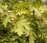
Bigleaf Maple1046 yd

Explorer Tom Bigleaf Maple in County Dublin is waiting for a bishop who refused to visit because he thought it looked too much like…
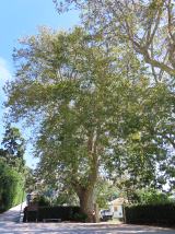
Oriental plane1076 yd

Explorer Tom Oriental plane in Dublin once smuggled a whole crate of cabbages up through its hollow trunk during the famine, or so…

Battle of RathminesMajor battlefield · 1483 yd

Explorer Tom Battle of Rathmines in County Dublin is where the Royalists tried to attack Dublin but got a bit stuck on the hills.…

Burning of the Custom HouseArmed conflict · 1499 yd

Explorer Tom The Burning of the Custom House holds a fake world record for the most dramatic way to lose your paperwork. It still…

Graveyard in Unknown TownlandGraveyard · 1.0 mi

Explorer Tom Graveyard in Dublin belonged to St John's medieval Parish Church and is marked 'Dis.' on old maps. Rocque's 1756 map…

Cathedral1.0 mi

Explorer Tom Cathedral. Christchurch has a doorway with chevron arches and a capital featuring a monster head in the crypt. It is…

More historic places in County Dublin · All of County Dublin

Add to this placeAdd a picture Add a detailed tip Add a story

Explore the map1,095,414 places to discover

Next place · or swipeUnited Arts Club