What is recorded here
Marked only on the 1924 ed. of the OS 6-inch map where it is described as St. Mochain’s Well. St Mochonóg is an early saint of Saxon and British parentage (Ó Riain 2011, 464), who is thought to have founded a monastery at Kilmuckrige (Ranson 1945, 53-4) and also at Galen, Co. Offaly (OF014-029----). The well is situated in mixed woodland in the valley of a small NW-SE stream on the NE bank and c. 30m from the stream. It is approached from the SE by a grass-covered concrete path. This is a natural spring within a square concrete-covered and white-washed enclosure (ext. dims. 1.25m N-S; 1.27m E-W; H 0.92m) with a pyramid canopy topped with a concrete cross and base. There is an arched opening (Wth 0.47m; H 0.41m) through the wall (T 0.5m) on its W side. The well is still venerated, but St. Mochonóg has no recorded feast-day. According to a marble plaque set over the opening the well was restored and probably brought into its present form in 1921, but patterns had been held at the well around the 27th September until c. 1900 (IFC Schools’ Collection, vol. 0887, 63-8). Killincooly church site (WX028-003001-) is c. 130m to the SE.
Marked only on the 1924 ed. of the OS 6-inch map where it is described as St. Mochain’s Well. St Mochonóg is an early saint of Saxon and British parentage (Ó Riain 2011, 464), who is thought to have founded a monastery at Kilmuckrige (Ranson 1945, 53-4) and also at Galen, Co. Offaly (OF014-029----). The well is situated in mixed woodland in the valley of a small NW-SE stream on the NE bank and c. 30m from the…
From the National Monuments Service (Archaeological Survey of Ireland) record WX028-002
The monument record does not grant public access. Check the route and ask the landowner before entering private land.
- What survives
- Recorded monument
Places near here
Photo credits
- National Inventory of Architectural Heritage
- Michael Dibb, Geograph · CC BY-SA 2.0
- Bruce Marlin, Wikimedia Commons · CC BY-SA 2.5
- sarah777, Wikimedia Commons · CC BY-SA 2.0
- Andrewmc, Wikimedia Commons · CC BY-SA 3.0
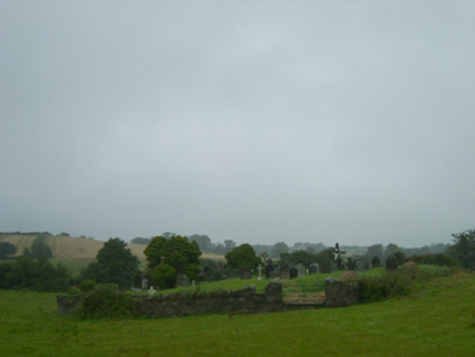 graveyard/cemetery152 ydHachured moundCastle, motte · 951 ydBrides WellHoly well · 1032 yd
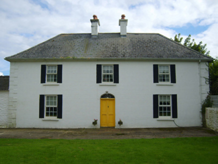 Killincooly HouseFarm house · 1068 ydEmbanked enclosureFairy fort / earthen ringfort · 1584 ydTinnaberna BeachBeach / strand · 1.1 miCastle Anneslwy (in ruins)Bawn · 1.7 mi
 Morriscastle BeachBeach / strand · 2.2 mi
 Fontainebleau service tree3.5 miFontainebleau service tree3.6 mi
 1798 MemorialMonument · 4.5 mi
.jpg/250px-1798_Monument_(1).jpg "Photo: Andrewmc, Wikimedia Commons · CC BY-SA 3.0") 1798 MonumentMemorial · 4.9 mi
1798 MonumentMemorial · 4.9 miMore archaeology and monuments in County Wexford · All of County Wexford
What do you know about this place?