What is recorded here
In undulating pasture, on N verge of marshy area, 6m outside W boundary wall of Kilfinny graveyard (LI030-011002-). Well consists of sunken stone-lined area (1m N-S; 1.4m E-W; D 0.8m), dry at time of visit. Enclosing this is recent stone wall with gate on S side giving access to three concrete steps down to well area. This stands atop raised roughly-circular platform (6m E-W; 5.5m N-S; H 0.45m) kerbed by remains of collapsed stone wall. According to Ó Danachair (1955, 205) 'rounds are still made by a few, especially on 9th September.'
The following folklore was recorded from Kilfinny National School about St. Kieran's Well; 'There is only one holy well in our district namely St Cieran's in the townland of Ballinakill. It is visited by people every year of the 9th Sept, the saints feast day. People go nine times around the Church year and nine times around the well which is just outside the church wall and say the Rosary three times while doing the rounds in the church yard and once going round the well. St Ciearan's footprint is said to be on one of the stone steps leading to the well. The well is specially recommended for cures of sore eyes. Anyone who has sore eyes bathes them with the water and takes a drink of it as well. Little pictures or medals are usually left behind at the well as souvenirs. There is a whitethorn bush growing beside it' (The Schools’ Collection, Volume 0498, Page 399; accessible online at www.duchas.ie/en/cbes/4922002/4917142/4950953?ChapterID=4922002). See attached photos taken in 1954 by Caoimhín Ó Danachair, courtesy of and © National Folklore Collection, UCD. The Photographic Collection, F025.21.00277 accessible online at www.duchas.ie/en/cbeg/24552; F025.21.00275 accessible online at www.duchas.ie/en/cbeg/17023 and F025.21.00276 accessible online at www.duchas.ie/en/cbeg/24551.
In undulating pasture, on N verge of marshy area, 6m outside W boundary wall of Kilfinny graveyard (LI030-011002-). Well consists of sunken stone-lined area (1m N-S; 1.4m E-W; D 0.8m), dry at time of visit. Enclosing this is recent stone wall with gate on S side giving access to three concrete steps down to well area. This stands atop raised roughly-circular platform (6m E-W; 5.5m N-S; H 0.45m) kerbed by remains…
From the National Monuments Service (Archaeological Survey of Ireland) record LI030-011003
The monument record does not grant public access. Check the route and ask the landowner before entering private land.
- What survives
- Recorded monument
Places near here
Photo credits
- National Inventory of Architectural Heritage
- SteveODowd, Wikimedia Commons · CC BY-SA 4.0
- Colin Park, Geograph · CC BY-SA 2.0
- Mike Searle, Wikimedia Commons · CC BY-SA 2.0
- EecherplazGinkgo06.jpg : Cayambe derivative work: Ginkgotree ( talk ), Wikimedia Commons · CC BY-SA 3.0
- Sitomon, Wikimedia Commons · CC BY-SA 2.0
- Callanmurphy, Wikimedia Commons · CC BY-SA 4.0
- Peter Craine, Wikimedia Commons · CC BY-SA 2.0
Grave YardGraveyard · 33 yd Ballynakill HouseCountry house · 288 ydKinnoor WellSpring · 855 ydLeprechaun CottageHouse · 1479 ydDysert AenghusaHeritage attraction · 1.8 miKnockfeerinaMountain / peak · 2.9 miFanningstown Castle (in ruins)Castle, tower house · 3.0 miLissamota CastleCastle · 3.2 miGinkgo3.2 miEuropean Yew3.2 miFranciscan AbbeyArchaeological place · 3.8 miAdare Desmond CastleMedieval castle · 3.8 mi
 Ballynakill HouseCountry house · 288 ydKinnoor WellSpring · 855 yd
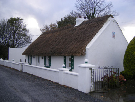 Leprechaun CottageHouse · 1479 yd
 Dysert AenghusaHeritage attraction · 1.8 mi
 KnockfeerinaMountain / peak · 2.9 mi
_-_geograph.org.uk_-_6276354.jpg/250px-Castles_of_Munster,_Fanningstown,_Limerick_(1)_-_geograph.org.uk_-_6276354.jpg "Photo: Mike Searle, Wikimedia Commons · CC BY-SA 2.0") Fanningstown Castle (in ruins)Castle, tower house · 3.0 mi
Fanningstown Castle (in ruins)Castle, tower house · 3.0 mi Lissamota CastleCastle · 3.2 mi
 Ginkgo3.2 mi
 European Yew3.2 mi
 Franciscan AbbeyArchaeological place · 3.8 mi
 Adare Desmond CastleMedieval castle · 3.8 mi
More archaeology and monuments in County Limerick · All of County Limerick
What do you know about this place?