
What is recorded here
Situated in a grove on the N shore of Killone Lake, 125m NE of Killone Augustinian nunnery (CL041-062001-). The well, dedicated to St. John, is just inside the W entrance to a subrectangular walled enclosure (29m E-W; 17-20m N-S). The well comprises a masonry wall aligned NNE-SSW built under rock outcrop. An entrance…
Read the whole record
From the National Monuments Service (Archaeological Survey of Ireland) record CL041-062003
Places near here
Photo credits
- Maker not stated on source page, ru.pinterest.com
- Molannaol, Wikimedia Commons · CC BY-SA 4.0
- Jackieray at English Wikipedia, Wikimedia Commons · Public domain
- Mike Searle, Wikimedia Commons · CC BY-SA 2.0
- Maker not stated on source page, www.alamy.com
- Maker not stated on source page, visitclare.ie
- Maker not stated on source page, commons.wikimedia.org
- National Inventory of Architectural Heritage
- Maker not stated on source page, www.pinterest.com
- Maker not stated on source page, www.youtube.com
- Clarecastle G.A.A. club page; individual photographer not named, clarecastlegaa.clubifyapp.com
- Kilmaley GAA Club (publisher; photographer not named), Source publisher
 Cursing stone in NewhallCursing stone · 7 yd
Explorer Tom Cursing stone in Newhall sits right next to an altar, which is just rude, like cursing at your dinner. I bet the last…
 Killone Abbey (in ruins)Religious house, Augustinian nuns · 159 yd
Explorer Tom Killone Abbey was an Augustinian nunnery where the sisters probably had a very good sense of humour. Bring a map, get…
 Killone AbbeyHeritage attraction · 164 yd
Explorer Tom This other Killone Abbey is having a serious drama with the nearest tree, claiming the roots are trying to steal its…
 Newhall HouseCountry house · 743 yd
Explorer Tom Newhall House in Newhall is a c. 1765 red brick house attributed to Francis Bindon, with some earlier fabric possibly…
 Bullaun stone in FeaghBullaun stone · 869 yd
Explorer Tom Bullaun stone in Feagh is secretly proud of the potato it grew next to it last summer, which was genuinely huge. Best…
 Megalithic structure in BallybegMegalithic structure · 956 yd
Explorer Tom This Ballybeg megalithic structure’s family tree is mostly made up by people who really want their ancestors to have…
 Fairy fort / earthen ringfort in Ballaghafadda WestFairy fort / earthen ringfort · 1196 yd
Explorer Tom Fairy fort / earthen ringfort in Ballaghafadda West is where the Vikings got lost looking for their ships. They…
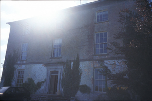 Barntick HouseFarm house · 1198 yd
Explorer Tom Barntick House in Barntick is a 1665 farmhouse with a carved limestone door surround that demands respect. It’s been…
 Rockmount Wood TrailsVisitor information · 1214 yd
Explorer Tom Rockmount Wood Trails is currently being managed by a fox who thinks he’s the head ranger and has stolen all the maps.…
 Fairy fort / stone ringfort in Cahircalla BegFairy fort / stone ringfort · 1505 yd
Explorer Tom Fairy fort / stone ringfort in Cahircalla Beg has a ghost that's too lazy to haunt anyone properly. Pretend you're a…
 Clarecastle GAA pitchGAA ground · 1.4 mi
 Kilmaley GAA LisbiggeenGAA ground · 4.9 mi
Explorer Tom Kilmaley's Lisbiggeen ground is the club's newer hurling home, with two pitches, a walkway and enough space for…
More archaeology and monuments in County Clare · All of County Clare

What do you know about this place?Tap to add a comment or ask a question