
What is recorded here
St. James' Well in the parish of Kilgobbin is located in a flat area, which has been heavily landscape due to its location within Stepaside Golf Course. A cross stands beside the well (DU026-004004-) both of which stand on the townland boundary with Jamestown located immediately to the S. Jamestown House located 166m…
Read the whole record
From the National Monuments Service (Archaeological Survey of Ireland) record DU026-004003
Places near here
Photo credits
- Maker not stated on source page, www.flickr.com
- National Inventory of Architectural Heritage
- Maker not stated on source page, ru.pinterest.com
- Maker not stated on source page, commons.wikimedia.org
- Gabriel Beranger (ca.1729-1817), Wikimedia Commons · Public domain
 Graveyard in KilgobbinGraveyard · 12 yd
Explorer Tom Graveyard in Kilgobbin has been heavily landscaped for a golf course, which is a bold move. It's just a levelled area…
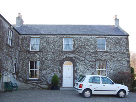 Jamestown HouseFarm house · 646 yd
Explorer Tom Jamestown House in Jamestown, County Dublin, thinks tourists from the city are just large, confused deer that wander…
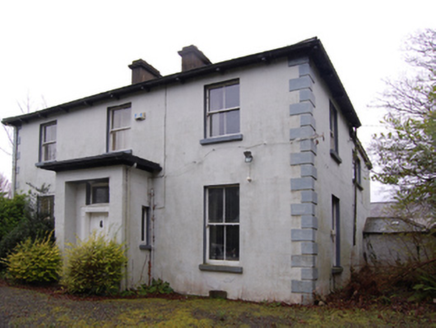 Clay FarmFarm house · 729 yd
Explorer Tom Clay Farm in Kilgobbin is a farmhouse from 1869 on a cruciform plan. It might have an older core from the thirties…
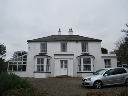 FirmountHouse · 859 yd
Explorer Tom Firmount, also known as Jamestown Lodge, looks like it’s hiding behind its porch because Saint Patrick would have…
 Holy well in KilgobbinHoly well · 905 yd
Explorer Tom Holy well in Kilgobbin was the 'Eye Well' near the old church, but a drain sunk nearby removed its spring entirely. Its…
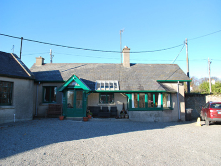 Saint Tiernan's Church (Kiltiernan)Sexton's house · 920 yd
Explorer Tom Saint Tiernan’s Church sexton’s house has been around since the 1837 survey. It’s a T-shaped plan with a gabled porch.…
 post box1028 yd
Explorer Tom Post box in Kilgobbin ended up here because it got lost on its way to Stepaside Lane. It’s got old Irish lettering on…
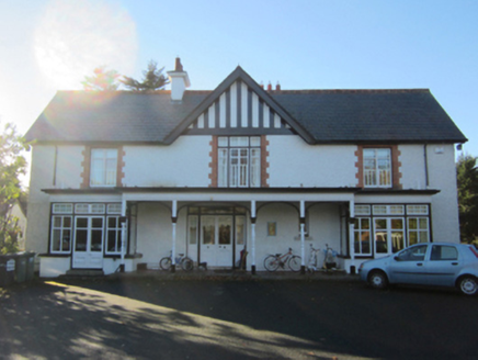 Greenfield HouseHouse · 1146 yd
Explorer Tom Greenfield House is a detached house from 1901 that might be reusing parts of an earlier house from 1837. It has a…
 Linear earthwork in KilgobbinLinear earthwork · 1260 yd
Explorer Tom Linear earthwork in Kilgobbin is a lane that used to be a bank, which then became a ditch, now it’s just a path. It’s…
 KilgobbinHouse · 1276 yd
Explorer Tom Kilgobbin in County Dublin is a late Georgian house with a 'peacock tail' fanlight, which sounds more like dinner than…
 Kilgobbin Castle (in ruins)Castle, tower house · 1363 yd
Explorer Tom Kilgobbin Castle in Kilgobbin is an impressive granite tower house that was nearly sold for a horse in some wild tale I…
 Mapped graveyardGraveyard · 1369 yd
Explorer Tom Mapped graveyard in County Dublin has had so many name changes it’s got more aliases than a spy in a bad thriller. I…
More archaeology and monuments in County Dublin · All of County Dublin

What do you know about this place?Tap to add a comment or ask a question