
What is recorded here
Situated on a shelf on top of cliffs overlooking Ardmore Bay to the N. St Declan’s Well has a masonry superstructure and is just 20m W of Dysert church (WA040-011001-). It has two openings and is surmounted by two (originally three) crosses, all late medieval in character. The S cross that is missing was illustrated…
Read the whole record
Situated on a shelf on top of cliffs overlooking Ardmore Bay to the N. St Declan’s Well has a masonry superstructure and is just 20m W of Dysert church (WA040-011001-). It has two openings and is surmounted by two (originally three) crosses, all late medieval in character. The S cross that is missing was illustrated by Westropp (1903, 377, 5) as a shield-shaped piece wider than it was tall with a crudely executed figure. The present S cross is a sandstone plaque (dims. H 0.46m; Wth 0.2m; T 0.12m) with a crucified figure. The N cross is a cross-shaped sandstone (H 0.58m; Wth 0.27m; T 0.12m) with a crucified figure. St Declan’s Stone (WA040-010----), also associated with the pattern, is on the beach c. 550m to WNW. (Power 1898b, 161; Westropp 1903, 376-7)
Power, Rev. P. (1898b) Excursion guides – 2: Ardmore. WAJ 4, 147-63. Westropp, T. J. (1903) Notes on the antiquities of Ardmore. JRSAI, 33, 353-80.
From the National Monuments Service (Archaeological Survey of Ireland) record WA040-011002
Places near here
Photo credits
- Colin Park, Geograph · CC BY-SA 2.0
- JulienWittenberg, Wikimedia Commons · CC BY-SA 4.0
- National Inventory of Architectural Heritage
- Slamforeman, Wikimedia Commons · CC BY-SA 3.0
- Andreas F. Borchert, Wikimedia Commons · CC BY-SA 4.0
- Paul Leonard, Geograph · CC BY-SA 2.0
- Oliver Dixon, Geograph · CC BY-SA 2.0
- john berry, Geograph · CC BY-SA 2.0
- Sitomon, Wikimedia Commons · CC BY-SA 2.0
- Towel401, Wikimedia Commons · CC BY-SA 4.0
- dougf, Geograph · CC BY-SA 2.0
 Dysert ChurchRuins · 24 yd
 Ardmore Cliff WalkWalking route · 29 yd
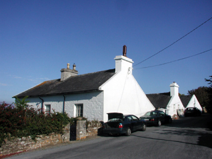 Rock HouseHouse · 90 yd
 St. Declans TombChurch · 976 yd
 Ardmore Round TowerMedieval round tower · 1013 yd
 Ardmore BeachBeach / strand · 1040 yd
 Whiting BayBeach / strand · 2.8 mi
 Ferry PointViewpoint · 5.4 mi
 European Yew6.0 mi
Explorer Tom European Yew in Cork says its mother-in-law designed it to be perfect, which is why it's so rigid and judgmental. She still checks up on it via the roots. Hang around long enough and you'll hear a story from a local.
 Capel IslandIslet · 7.5 mi
 Templemichael CastleCastle · 7.9 miTemplemichael Castle (in ruins)Castle, tower house · 7.9 mi
More archaeology and monuments in County Waterford · All of County Waterford

What do you know about this place?Tap to add a comment or ask a question