What is recorded here
In farmyard on NW-facing slope overlooking Argideen river estuary. Uncovered during digging of foundation trench by mechanical digger. Excavated by Hurley and O Drisceoil (1978, 94-97) who found 'boat-shaped' cist, long axis E-W (max. L 1.8m; max. Wth 0.5m; H 0.25m); lined and covered with slabs; floor formed by underlying bedrock. Remains of human skeleton found with skull to W end and feet to (narrow) E end.
From the National Monuments Service (Archaeological Survey of Ireland) record CO123-053
The monument record does not grant public access. Check the route and ask the landowner before entering private land.
- What survives
- Recorded monument
Places near here
Photo credits
- Garry Dickinson, Geograph · CC BY-SA 2.0
- National Inventory of Architectural Heritage
- A.-K. D., Wikimedia Commons · CC BY-SA 4.0
- Ingo Mehling, Wikimedia Commons · CC BY-SA 3.0
- Jonathan Thacker, Geograph · Creative Commons Attribution-ShareAlike 2.0
Railway Timoo CourtmacsherryVisitor information · 766 yd Timoleague CastleCastle, tower house · 808 ydTimoleague HouseHouse · 825 ydTobernabantiernaHoly well · 876 ydKilnamanagh WoodWood · 920 ydUmmera HouseHouse · 961 ydTimoleague FriaryVisitor information · 1058 ydTimoleague AbbeyHeritage attraction · 1094 ydGraveyard1131 ydRail SignalHeritage attraction · 1170 ydJohnny Sheila MurphyMemorial · 1.3 miBurrane Castle (Site of)Castle, unclassified · 1.4 mi
 Timoleague CastleCastle, tower house · 808 yd
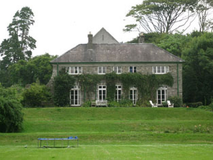 Timoleague HouseHouse · 825 ydTobernabantiernaHoly well · 876 ydKilnamanagh WoodWood · 920 yd
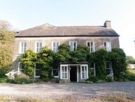 Ummera HouseHouse · 961 yd
 Timoleague FriaryVisitor information · 1058 yd
 Timoleague AbbeyHeritage attraction · 1094 yd
 Graveyard1131 ydRail SignalHeritage attraction · 1170 ydJohnny Sheila MurphyMemorial · 1.3 miBurrane Castle (Site of)Castle, unclassified · 1.4 mi
More archaeology and monuments in County Cork · All of County Cork
What do you know about this place?