Places near here
Photo credits
- Michael Dibb, Geograph · Creative Commons Attribution-ShareAlike 2.0
- Yosemite, Wikimedia Commons · CC BY-SA 3.0
- Josh Jackson, Wikimedia Commons · CC BY 2.0
- National Inventory of Architectural Heritage
- Dr Charles Nelson, Geograph · CC BY-SA 2.0
- Keith Cunneen, Geograph · CC BY-SA 2.0
- Trevor Harris, Geograph · CC BY-SA 2.0
- William Herbert Stokes (1845-1874), Wikimedia Commons · Public domain
- David Purchase, Geograph · CC BY-SA 2.0
- Peter Ribbans, Wikimedia Commons · CC BY-SA 2.0
- Nigel Cox https://www.geograph.org.uk/profile/2798, Wikimedia Commons · CC BY-SA 3.0
 Burial GroundGraveyard · 1.5 mi
Explorer Tom Burial Ground in Kilmakilloge sits on a ridge that looks down its nose at tourists from Dublin who can't find their left foot. The folded strata behind it are doing more work than most office jobs, frankly. Pack a picnic and an excuse.
 Japanese cedar2.3 mi
Explorer Tom A Japanese cedar in County Kerry claims it’s older than the hills, which is definitely a lie. But who wants to argue with a tree that looks like a castle? Tell the kids it's a castle. Close enough.
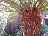 Soft Tree-fern2.3 mi
Explorer Tom Soft Tree-fern in County Kerry nearly got famous for being too soft to handle its own glory. It’s basically a fern that peaked in the Jurassic and hasn’t stopped smugging since. Make a wish, it's had centuries of practice.
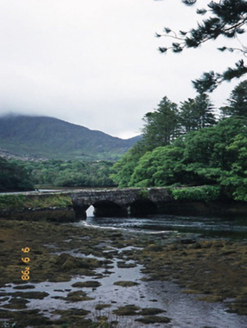 Cappul BridgeBridge · 2.3 mi
Explorer Tom Cappul Bridge posts photos of the tidal river on its social media feed to prove it's living a double life. It spans the Croanshaugh and acts like it owns the whole water system, which is bold for an eighteen-year-old. Make a wish, it's had centuries of practice.
 Derreen HouseHouse · 2.3 mi
Explorer Tom Derreen House in Kerry had a first owner with an escape plan involving rhododendrons and tree ferns. Built around 1865, it’s an L-plan beauty that probably thinks its gardens are the real main event. The pointed-arch porch suggests it wanted to look fancy without trying too hard. Bring a flask and pretend you own the place.
 CoomacloghaneMountain / peak · 2.3 mi
Explorer Tom Coomacloghane’s first owner tried to escape by selling it to a man who only paid in cheese, which was a massive mistake given the weather. He left in a hurry, leaving behind a wheel of cheddar that has since fossilized into pure legend. Sit on a wall near it and pretend you're in a painting.
 KnockateeMountain / peak · 2.8 mi
Explorer Tom Knockatee in County Kerry has a very strong opinion that the road leading to it is an insult to its dignified standing in the community. It thinks the tarmac is too noisy and frankly not up to scratch for such a distinguished hilltop presence. Great spot to propose. Or at least to propose lunch.
.JPG/250px-Derryquin_Castle_c.1870._Pen_%26_ink_sketch_by_William_Herbert_Stokes_(1845-1874).JPG "Photo: William Herbert Stokes (1845-1874), Wikimedia Commons · Public domain") Derryquin CastleRuins · 3.7 mi
Derryquin CastleRuins · 3.7 miExplorer Tom Derryquin Castle smells like old damp and regret, according to my nose, which is usually right about things. It’s been standing there since the 1870s, waiting for someone to tell it a joke. Tell it a joke, it's been a long time since anyone did.
 GarinishIslet · 4.0 mi
Explorer Tom Garinish started because two lads bet fifty quid that one could plant ferns on a rock and make them look classy. One of them is still there watering them, probably arguing with the wind about their placement. Practise your Irish on it, it won't correct you.
 Rossmore IslandIsland · 4.3 mi
Explorer Tom Rossmore Island has a secret it only tells after three pints, and trust me, it gets really messy and loud. It claims it once hosted a king who lost his hat in the surf. Bring curiosity, leave with a better story than mine.
 Ballycrovane Ogham StoneVisitor attraction · 5.9 mi
Explorer Tom The Ballycrovane Ogham Stone claims King Arthur once leaned on it while complaining about his back, which nobody can prove but everyone believes. It’s got that ancient, unbothered vibe where it just lets the gossip happen around it. Bring the dog, it'll have opinions.
 Hag of BearaMonument · 6.5 mi
Explorer Tom Hag of Beara in County Cork is stuck in a long-standing grudge with the weather, which keeps trying to blow her away. She just sits there smirking, waiting for the sea god husband who never quite shows up when he promised he would. Make up your own legend and I'll swear it's true.
More archaeology and monuments in County Kerry · All of County Kerry

What do you know about this place?Tap to add a comment or ask a question