
Places near here
Photo credits
- JohnArmagh, Wikimedia Commons · CC BY-SA 3.0
- Steve Edge, Wikimedia Commons · CC BY-SA 2.0
- National Inventory of Architectural Heritage
- David Purchase, Geograph · CC BY-SA 2.0
- Fthierygeo, Wikimedia Commons · CC BY 4.0
- Philip Pötsch, Philipweb, Wikimedia Commons · CC BY 4.0
- Oliver Dixon, Geograph · CC BY-SA 2.0
- Bjørn Christian Tørrissen, Wikimedia Commons · CC BY-SA 3.0
- Humphrey Bolton, Geograph · CC BY-SA 2.0
 Church IslandEcclesiastical site · 1.8 mi
Explorer Tom Church Island hides a treasure that’s definitely a biscuit tin left by a bored monk in the sixth century. St Finan Cam…
 Inny StrandBeach / strand · 4.8 mi
Explorer Tom Inny Strand lays out a long stretch of Kerry shore and then tempts you to keep walking. Near Ballinskelligs, it is also…
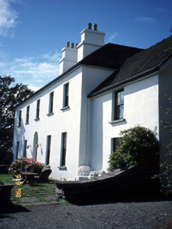 Westcove HouseHouse · 5.1 mi
Explorer Tom Westcove House in Coad had a first owner whose escape plan involved hiding in the garden until everyone left. It’s…
 Traigh an ChomaBeach / strand · 24 mi
Explorer Tom Traigh an Choma has a hidden message in its stones if you squint just right and ignore the wind. It’s probably saying…
 Ogham stone in Com Dhíneol ThuaidhOgham stone · 25 mi
Explorer Tom Ogham stone in Com Dhíneol Thuaidh: If it were a person at a wedding, it would be the uncle who stands on the headland…
 An Dún MórHeadland · 25 mi
Explorer Tom An Dún Mór is the headland where a matchmaker once worked and successfully paired off two clouds that are still…
 Dunmore HeadViewpoint · 25 mi
Explorer Tom Dunmore Head in County Kerry would tell a job interview it has excellent exposure to the Atlantic and zero patience for…
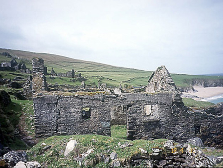 school25 mi
Explorer Tom School in Great-Blasket Island would handle a nosey neighbour by simply letting the wind do all the talking. It’s now a…
 Children's burial ground in An Blascaod MórChildren's burial ground · 25 mi
Explorer Tom Children's burial ground in An Blascaod Mór hosted a dramatic windstorm that blew a shepherd’s hat into the bay. The…
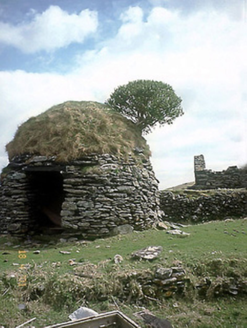 An Púicín BuíOutbuilding · 25 mi
Explorer Tom An Púicín Buí on Great Blasket would teach history by just sitting there looking round and mossy. It’s a beehive-shaped…
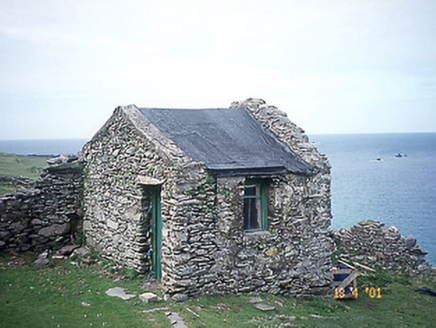 Tigh an Rí [The King's House]House · 25 mi
Explorer Tom Tigh an Rí on Great-Blasket Island is what Saint Patrick would have called a very expensive shed with royal ambitions.…
 Ionad an Bhlascaoid MhóirMuseum · 25 mi
Explorer Tom At Ionad an Bhlascaoid Mhóir in Dún Chaoin, the Blasket Islands sit across the water looking close enough to borrow a…
More archaeology and monuments in County Kerry · All of County Kerry

What do you know about this place?Tap to add a comment or ask a question