Places near here
Photo credits
- Michael Murtagh, Geograph · CC BY-SA 2.0
- National Inventory of Architectural Heritage
- Picture: en.wikipedia.org
- NTF30, Wikimedia Commons · CC BY-SA 4.0
- Jacobfrid, Wikimedia Commons · CC BY-SA 4.0
- John M, Geograph · CC BY-SA 2.0
- Jon Sullivan, Wikimedia Commons
- Oliver Dixon, Geograph · CC BY-SA 2.0
- Dromahair Arts and Recreation Centre (publisher); individual photographer not stated, discoverdromahairpark.ie
- Malene Thyssen, Wikimedia Commons · CC BY-SA 3.0
- Willie Duffin, Wikimedia Commons
 Arroo MountainMountain / peak · 1.6 mi
Explorer Tom Arroo Mountain got its name wrong on the map because the cartographer was drunk on a particularly potent local cider…
 The Old RectoryRectory/glebe/vicarage/curate's house · 1.7 mi
Explorer Tom The Old Rectory in Laghta has a bird that refuses to leave the garden despite being offered a better life in town. It…
 Melvin Gaels GAAGAA ground · 1.8 mi
 water pump1.9 mi
Explorer Tom Water pump in Kinlough was named after a poet who fell in the ditch nearby and never fully recovered his dignity. It…
 TievebaunMountain / peak · 2.8 mi
Explorer Tom Tievebaun is a mountain that can be seen all the way from Sligo beach, which makes it feel like a celebrity who refuses…
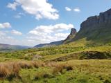 Eagle's RockMountain / peak · 3.1 mi
Explorer Tom Eagle's Rock is under a curse that only hits people who forget to wave at it properly on the way past. It's a very…
 Glencar WaterfallWaterfall · 6.1 mi
Explorer Tom Glencar Waterfall has a theatrical entrance for a place that never bought a ticket: you leave the shore of Glencar…
 The Devil's ChimneyWaterfall · 6.2 mi
Explorer Tom The Devil's Chimney is a waterfall that sometimes refuses to fall. A southerly wind can blow its water back over the…
 Glencar IslandIslet · 6.3 mi
Explorer Tom Glencar Island in County Leitrim would complain to the council about the noise levels from the swans, claiming they’re…
 Dromahair Park, St. Patrick's GAA, DromahaireGAA ground · 13 mi
 European Beech15 mi
Explorer Tom European Beech in County Donegal is a tree that pretends to be from somewhere warmer but lives here anyway. Vikings…
 KillybegsHistoric town · 16 mi
Explorer Tom Killybegs looks out over one of Donegal's finest natural harbours, and the town has the wonderfully honest energy of a…
More historic places in County Leitrim · All of County Leitrim

What do you know about this place?Tap to add a comment or ask a question