Places near here
Photo credits
- Trevor Harris, Geograph · CC BY-SA 2.0
- Gordon Hatton, Geograph · CC BY-SA 2.0
- David Purchase, Geograph · CC BY-SA 2.0
- National Inventory of Architectural Heritage
- Dr Charles Nelson, Geograph · CC BY-SA 2.0
- Josh Jackson, Wikimedia Commons · CC BY 2.0
- Yosemite, Wikimedia Commons · CC BY-SA 3.0
- Michael Dibb, Geograph · Creative Commons Attribution-ShareAlike 2.0
- Espresso Addict, Wikimedia Commons · CC BY-SA 2.0
- Mick Garratt, Geograph · CC BY-SA 2.0
- Richard Webb, Wikimedia Commons · CC BY-SA 2.0
- Robotforaday at en.wikipedia, Wikimedia Commons · Public domain
 KnockateeMountain / peak · 1.3 mi
 Ormond's IslandIslet · 1.8 mi
 Rossmore IslandIsland · 2.1 mi
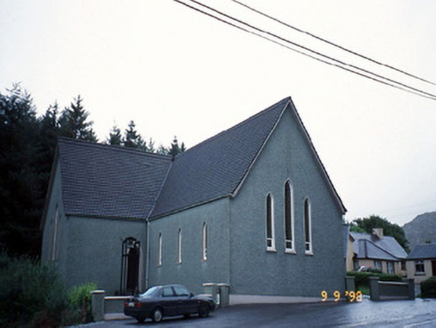 Saint Killian's Catholic ChurchChurch/chapel · 2.3 mi
Explorer Tom Saint Killian's Catholic Church in Derreen would complain to the council about the lack of parking for angels. It’s got a triangular porch that looks like it was cut with a knife. Mind the nettles, they're the real guards here.
 Derreen HouseHouse · 2.4 mi
Explorer Tom Derreen House in Kerry had a first owner with an escape plan involving rhododendrons and tree ferns. Built around 1865, it’s an L-plan beauty that probably thinks its gardens are the real main event. The pointed-arch porch suggests it wanted to look fancy without trying too hard. Bring a flask and pretend you own the place.
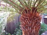 Soft Tree-fern2.4 mi
Explorer Tom Soft Tree-fern in County Kerry nearly got famous for being too soft to handle its own glory. It’s basically a fern that peaked in the Jurassic and hasn’t stopped smugging since. Make a wish, it's had centuries of practice.
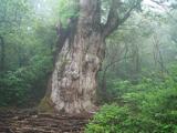 Japanese cedar2.4 mi
Explorer Tom A Japanese cedar in County Kerry claims it’s older than the hills, which is definitely a lie. But who wants to argue with a tree that looks like a castle? Tell the kids it's a castle. Close enough.
 Burial GroundGraveyard · 2.4 mi
 Uragh Stone CircleArchaeological place · 3.1 mi
 Lackeen PointHeadland · 3.4 mi
 KnockastumpaMountain / peak · 3.7 mi
 Dromore CastleCastle · 4.3 mi
More archaeology and monuments in County Kerry · All of County Kerry

What do you know about this place?Tap to add a comment or ask a question