Places near here
Photo credits
- Picture: www.kerrygaa.ie
- Colin Park, Geograph · CC BY-SA 2.0
- Adrian King, Geograph · CC BY-SA 2.0
- National Inventory of Architectural Heritage
Explorer Tom Hut site in Annagh More is rectangular because a cow once tried to buy it with a handful of shiny beetles. The deal…
Field system in Annagh MoreField system · 106 ydExplorer Tom This Field system in Annagh More claims to hold the world record for the most confusingly shaped fields in County…
Field boundary in Annagh MoreField boundary · 370 ydExplorer Tom Field boundary in Annagh More has an imaginary fan club of very serious cows who think it’s the best fence ever built.…
Fulacht fia in Annagh MoreFulacht fia · 403 ydExplorer Tom Fulacht fia in Annagh More claims there is a hidden tunnel underneath that leads straight to the local pub for free…
Enclosure in Annagh MoreEnclosure · 478 ydExplorer Tom This Annagh More enclosure would give you two stars out of five for visiting because you tracked mud in its living…
CoolcurtogaMountain / peak · 1581 ydExplorer Tom Coolcurtoga in County Kerry is pretending to be prehistoric, but I reckon it’s just been napping since the Stone Age.…
 Glenflesk GAA pitchGAA ground · 1.8 mi
 The Paps WestMountain / peak · 2.0 mi
Explorer Tom The Paps West has been in a furious fairy dispute over parking rights with the clouds for the last three centuries. The…
 Knocknagree Roman Catholic ChurchChurch/chapel · 9.4 mi
Explorer Tom Knocknagree Roman Catholic Church is having a quiet rivalry with every other church in town. It’s got Gothic lancets…
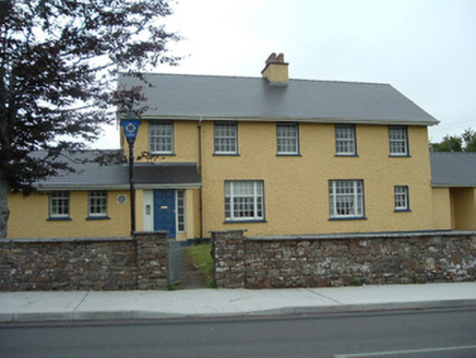 Knocknagree Garda StationGarda station/constabulary barracks · 9.4 mi
Explorer Tom 17. Knocknagree Garda Station looks like a fancy country house because it was built in the Domestic Revival style…
 house11 mi
Explorer Tom House in Mullaghroe South is where a Viking got lost and decided to build his own house instead of finding the beach.…
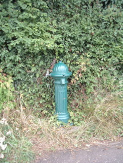 water pump11 mi
Explorer Tom Water pump in Mullaghroe North has been standing there since the 1880s, looking very Victorian about it. It’s a…
More archaeology and monuments in County Kerry · All of County Kerry

What do you know about this place?Tap to add a comment or ask a question