DDiscover AloneMapAbout

Sheean

Burial mound
Computer-made picture that does not show SheeanNot a photo of this monument
Computer-made picture. It does not show this monument. · Report the wrong picture

The monument record does not grant public access. Check the route and ask the landowner before entering private land.

What do you know about this place?Tap to add a comment or ask a question

What you write will be public.

What is recorded here

National Monument No. 313. No surface trace of low knoll originally enclosed by a bank enclosing an area measuring 150m in diameter which was levelled in the 1980's, revealing several extended skeletons seven of which were fully excavated. The remains were of both sexes, children and adults in pits orientated E-W with…

Read the whole record
National Monument No. 313. No surface trace of low knoll originally enclosed by a bank enclosing an area measuring 150m in diameter which was levelled in the 1980's, revealing several extended skeletons seven of which were fully excavated. The remains were of both sexes, children and adults in pits orientated E-W with the head to the W which were excavated by the National museum (NMI 1985) prior to its destruction. There was evidence of successive burial and perhaps also of burial in rows. No finds were made. Human bones were also unearthed in another glacial knoll some 200m to the N (NMI file 1985). Prior to its destruction this earthwork was described by Reynolds (1972) as a partially destroyed mound enclosed by a bank visible at NE with wide external fosse visible at N only. According to Davies (ITA Survey 1942) the site which he described as a fort consisted of a circular area (diam. 14yds) enclosed by earthen bank (ext. H 2-3 ft.) and external fosse. On the NE side there was a deep depression 9 ft. wide which cut through the ridge, sloping SE the enclosing bank rises up to a height of 9 ft. from the depression. This depression appears to be ancient and may have been an old trackway running through the ridge; its depth on the side away from the fort is up to 5 ft, the bank rises 1 ft from inside on E and is level on the other sides. The centre slopes SW and few old trees are growing on it (ITA Survey 1942). Described in 1977 as an earthwork or a partly destroyed ringfort that is enclosed by an earthen bank and external fosse (ASI file). This fort or mound was located on a natural glacial knoll with early Christian site (OF009-005----) to the NNW and remains of early Christian enclosure in the same field (OF009-005003-). This earthwork was described by the Offaly Historical and Archaeological Society in the 1970's as consisting of a raised oblong shaped platform (H 0.75m; dims. 20m N-S by 16m E-W) situated on a ridge that is cut to a depth of 3m at NE side. A second mound (OF009-031----) described by Davies in 1942 was located nearby to the SW. It is unclear whether this cemetery that was excavated by the National Museum in 1985 incorporated the two earthworks (OF009-006----/031----), one of which was marked on the OS 6-inch maps as Sheean Hill. The cemetery or burial ground appears to have been a much larger site that was defined by a bank enclosing an area approx. 150m in diameter. The relationship betweent the two earthworks (OF009-006----/031----) is unclear.

From the National Monuments Service (Archaeological Survey of Ireland) record OF009-006

Places near here

Photo credits
  • Maker not stated on source page, en.wikipedia.org
  • kevin higgins, Wikimedia Commons · CC BY-SA 2.0
  • National Inventory of Architectural Heritage
  • Mike Searle, Geograph · CC BY-SA 2.0
  • Maker not stated on source page, www.pinterest.com
  • Maker not stated on source page, pxhere.com
  • Kmcnamee, Wikimedia Commons · CC BY-SA 4.0
  • Willow, Wikimedia Commons · CC BY 2.5
  • Maker not stated on source page, ie.pinterest.com
Standing stone in Durrow DemesneStanding stone · 295 yd

Explorer Tom Standing stone in Durrow Demesne is unlocated, which means you can’t complain if you miss it. The wind has been…

Ecclesiastical enclosure in Durrow DemesneEcclesiastical enclosure · 323 yd

Explorer Tom Ecclesiastical enclosure in Durrow Demesne, County Offaly was founded by Colum Cille, who died in 597 and is now mostly…

Durrow High CrossVisitor attraction · 346 yd

Explorer Tom Durrow High Cross is absolutely sick of being asked if it’s still standing, like it’s some kind of fragile antique that…
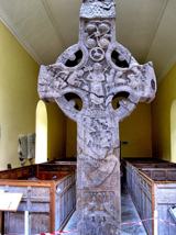
St. Columbkilles CrossCross, High cross · 346 yd

Explorer Tom St. Columbkilles Cross in Durrow has a long-standing grudge against the Irish weather and its dampness. It’s been…
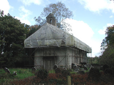
Durrow AbbeyChurch/chapel · 348 yd

Explorer Tom Durrow Abbey in Durrow Demesne has a high cross hiding inside like a secret. A love story went wrong next door and the…
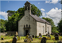
St Columbas Ch (Disused)Church · 348 yd

Explorer Tom St Columbas Ch (Disused) in Durrow Demesne has been rebuilt so many times it should have asked for a refund by now. Its…

St Columba's GraveyardGraveyard · 356 yd

Explorer Tom St Columba's Graveyard in County Offaly has this local who swears he invented the concept of burying people there. He…

Durrow MoatCastle, motte · 551 yd

Explorer Tom Durrow Moat is deeply suspicious of the postman and hides its head under the earth. Hugh de Lacy died there, so don't…

Durrow CemeteryGraveyard · 899 yd

Explorer Tom Durrow Cemetery ended up in completely the wrong place because someone misread a map. It looks totally confused sitting…

Durrow GAA pitchGAA ground · 1018 ydEuropean ash1.4 mi

Explorer Tom This European ash in County Offaly is hiding a scandal about which branch grew first, and nobody agrees. It keeps the…

Hollow House on site of CastleBawn · 2.3 mi

Explorer Tom Hollow House on site of Castle was built on a bargain where the devil got the best deal. The bawn walls are just…

More archaeology and monuments in County Offaly · All of County Offaly

Add to this placeAdd a picture Add a detailed tip Add a story

Explore the map1,095,414 places to discover

Next place · or swipeStanding stone in Durrow Demesne
