
What is recorded here
Located on a shelf towards the bottom of a N-facing slope. Just S of the castle (ME014-027----) a subrectangular area (dims c. 90m ENE-WSW; c. 70m NNW-SSE) contains relict field banks or scarps creating small rectangular fields (dims c. 30m x c. 20m to c. 50m x c. 50m) amongst which are the foundations of at least two houses (dims c. 8m x 4m to 10.5m x 5m). A third structure (ext. dims 17.8m E-W; 7.2m N-S; int. dims 10m E-W; 4.4m) with a wide gap (Wth 4m) in the S wall is thought to be a church.
The above description is derived from the published 'Archaeological Inventory of County Meath' (Dublin: Stationery Office, 1987). In certain instances the entries have been revised and updated in the light of recent research.
Compiled by: Michael Moore
Date of revision: 22 November 2018
Amended: 15 December 2022
The monument record does not grant public access. Check the route and ask the landowner before entering private land.
- What survives
- Recorded monument
Places near here
 EnclosureEnclosure, large enclosure · 600 yd
 Field system in Annagh (fore By.)Field system · 936 yd
 TemplefanumChapel · 1448 yd
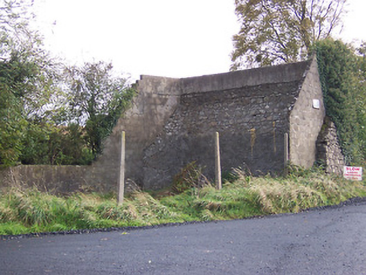 handball alleyhandball alley · 1609 yd
 European BeechEuropean Beech · 1.1 mi
 Hilltown Castle (in ruins)Castle, tower house · 1.4 mi
 Fore AbbeyHeritage attraction · 1.9 mi
 Ben of ForeMountain / peak · 2.0 mi
 CastleCastle, tower house · 2.2 mi
 Seafin HillMountain / peak · 2.3 mi
 Mullaghmeen ForestPicnic place · 3.2 mi
 European ashEuropean ash · 3.7 mi
Other information
Photo: Credit not shown in the picture search · Rights wording not checked; contact us if this picture should be removed