
What is recorded here
Hilltown Castle stands as a two-storey limestone ruin whose collapsed vault still braces the east wall, now absorbed into the western end of a farmyard outhouse. Built with rounded corners and a small north-west turret that may have been solid rather than a chamber, the tower survived the upheavals that changed its owners from Lady Marie Nugent to Nicholas Archbold. Its blocked stairs and rebuilt entrance suggest a private defensive home where firelight, not grand display, shaped daily life.
The ruins of Hilltown Castle are now incorporated into W end of farmyard outhouse belonging to Hilltown House located 75m to S. Hilltown House described by the National Inventory of Architectural Heritage as a 'Detached three-bay three-storey over basement Palladian country house, built c.1780' (www.buildingsofireland.ie). In 1606 the lands of Hilton (Hilltown) including 2 messuages, certain cottages, and 240 acres of arable land formed part of the land grant to Lady Marie Nugent, widow of Christopher, baron of Delvin, deceased, and to her son, Richard, now baron of Delvin (Erck 1846-52, 203-04). No castle is depicted in this townland on the 1657 Down Survey map of Fore Barony (NLI, MS 723-4). The terrier of the Down Survey map of St. Feighin's parish lists Nicholas Archbold, an Irish papist, as the owner of the lands of 'Hiltowne' in 1641 (ibid.).
Rectangular-shaped two storey high tower house (ext. dims. 11.5m N-S; 9.4m E-W; W wall T 1.8m; S wall T 2.2m) with rounded corners and a small square-shaped projecting turret (ext. dims. 3.1m N-S x 2m E-W) at N end of W wall. Built of coursed limestone rubble with a slight base batter visible on the W wall, roughly shaped long and short alternating quoins. The main entrance at the W end of the S wall has been rebuilt and consists of a flat rectangular opening which gives access to a lobby area with access to mural stairs in E wall of lobby. The mural stairs now blocked up in the S wall which gives access to first floor level near the SE angle of the first floor. The castle survives two storeys high and the springers of a collapsed stone vault over the ground floor (approx. int. dims. 7.5m N-S x 5.8m E-W) can still be seen in the E wall. There is no access to the corner turret on the NW angle at ground floor level & without a ladder it is not possible to ascertain whether there is access at 1st floor level or not. It has been suggested that this corner tower is solid masonry and may have acted as a buttress on the NW angle of the castle. A probable broken out window gap in E wall. A window with external splay visible in W wall. A fireplace is present in the N wall of the first floor and there is a double-splayed ope in the W wall (Salter 2004, 150) No dressed or decorated stones are visible. A two-bay, two-storey high house, built c.1725 which was later used as an outbuilding extends E off the N end of the E wall of the castle.
Compiled by: Frank Coyne & Caimin O'Brien
Date of upload: 2 December 2016
The monument record does not grant public access. Check the route and ask the landowner before entering private land.
- What survives
- Recorded monument
Places near here
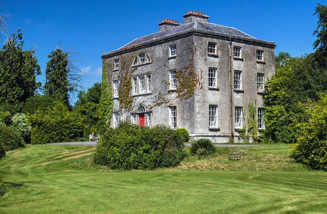 Hilltown Housecountry house · 95 yd
 IndicatedFairy fort / earthen ringfort · 716 yd
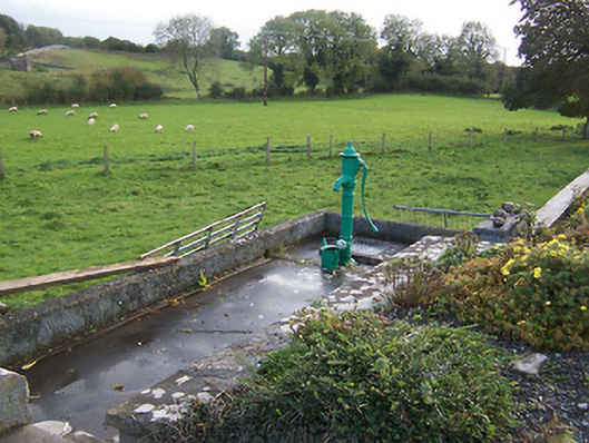 water pumpwater pump · 996 yd
 Enclosure in TonashammerEnclosure · 1039 yd
 CastleCastle, unclassified · 1.1 mi
 Mullaghmeen ForestPicnic place · 1.9 mi
 Hachured, dotted outlineCastle, motte and bailey · 1.9 mi
 Rock of CurryCliff · 3.1 mi
 European ashEuropean ash · 3.2 mi
 Seafin HillMountain / peak · 3.6 mi
 Silver FirSilver Fir · 3.9 mi
 Mount FortuneMountain / peak · 4.2 mi
Other information
Photo: Credit not shown in the picture search · Rights wording not checked; contact us if this picture should be removed