
What is recorded here
Situated on top of a high steep ridge in grassland, with commanding views of the surrounding countryside. Tower house (WM003-066----) 280m to S, 17th century wayside cross (WM003-069---) 50m to W, Rathgarve church (WM003-068----) and graveyard (WM003-068001-) 120m to NNW. Stream which forms the townland boundary with Stonestown is 150m to E. The remains of a narrow roadway flanked on either side by a low stone wall 50m W of motte and bailey could be medieval in date.
Present remains consist of a high steep, flat topped earthen mound (top diam. 18m E-W; base diam. 30m E-W) now covered in scrub vegetation which is enclosed by a wide, deep fosse and earthen bank, with a narrow causeway across the fosse at N. To N of the motte is a rectangular bailey (approx. dims. 32m N-S x 29m E-W) enclosed by an earthen bank and fosse. The enclosing bank is visible only at N. Traces of cultivation ridges are visible running WSW-ESE across the interior of the bailey.
See attached plan of monument surveyed and drawn by the ASI.
Compiled by: Frank Coyne and Caimin O'Brien
Date of upload: 22 May 2017
A local castle; wider significance not recorded.
The monument record does not grant public access. Check the route and ask the landowner before entering private land.
- What survives
- Recorded monument
Places near here
 CrossCross, Wayside cross · 90 yd
 Ecclesiastical enclosure in RathgarveEcclesiastical enclosure · 176 yd
 Church (in Ruins)Church · 180 yd
 CastleCastle, tower house · 367 yd
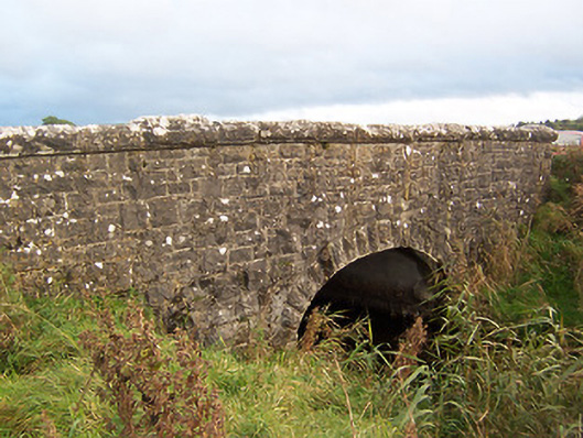 Stonestown Bridgebridge · 684 yd
 European ashEuropean ash · 1.3 mi
 Hilltown Castle (in ruins)Castle, tower house · 1.9 mi
 Silver FirSilver Fir · 1.9 mi
 Rock of CurryCliff · 2.3 mi
 Mullaghmeen ForestPicnic place · 2.9 mi
 Fore AbbeyHeritage attraction · 3.0 mi
 Mullaghmeen Red WalkWalking route · 3.3 mi
Other information
Photo: Credit not shown in the picture search · Rights wording not checked; contact us if this picture should be removed