What is recorded here
Earthworks in field to WSW of medieval chapel of Kilcurly which are visible on Google earth aerial photograph taken 05/02/2009 may be the remains of a medieval settlement. Medieval chapel (LI012-068---) of 'Kilkerill' [Cill Choireallaigh/Kilcurley] shown standing to NE of a substantial dwelling with a second building to S on the 1657 Down Survey map of Kenry Barony (NLI, MS 718). The earthworks visible on Google Earth photographs may be the remains of these two dwellings depicted on the 1657 Down Survey map. The buildings depicted on the 1657 Down Survey map of Kenry Barony may be the same structure described in the 1654-56 Civil Survey of Limerick which recorded that on the lands of John Lissaght of Kilcurly there was 'one good dwelling house, ten Cottages, and one Salmon weare [LI012-155----] seate upon it' (Simington 1938, 362). It is not clear if the 10 cottages were located throughout the townland or clustered around the 'good dwelling' described in the Civil Survey. The ridge and furrow ridges visible may represent the remains of post-1700 field system. To the NW and W are two fields containing cultivations ridges running E-W in field containing ringfort and running N-S in field to S of roadway. These cultivation ridges are probably post-1700 in date. The cluster of earthworks are confined within an oval-shaped area (approx. diam. 150m) with roadway to Kilcurly House to N and field boundary to S with curvilinear enclosing bank visible at E and W. Contained within the curvilinear earthwork are a series of lower earthworks some of which form rectangular shaped areas visible in NE quadrant. The pattern of earthworks is not clear and some of them may represent topographical features. On this 1840 ed. OS 6-inch map this field is depicted as an area of rock outcrop. In 1595 Queen Elizabeth granted Henry Wallop 'half a carucate in Kylcoille alias Kilkrile with a mill (LI012-150-)' (Nicholls 1994, 261). These lands were first granted in 1587 when they were described as containing 'In Kilcoill, alias Kill Kryle, 3 Messuages, 2 Cottages, 24a. arable, 6a. pasture, & underwood, and the foundation of a Watermill [LI012-150----], & other lands containing ½ a Plowland' (Dunraven 1865, 253). See attached 1657 Down Survey map of Kenry Barony showing dwellings to SW of Kilcurly chapel and Google earth aerial photograph showing cropmarks of possible buildings with associated earthworks. Rob O'Hara
Date of upload: 17 February 2020
Earthworks in field to WSW of medieval chapel of Kilcurly which are visible on Google earth aerial photograph taken 05/02/2009 may be the remains of a medieval settlement. Medieval chapel (LI012-068---) of 'Kilkerill' [Cill Choireallaigh/Kilcurley] shown standing to NE of a substantial dwelling with a second building to S on the 1657 Down Survey map of Kenry Barony (NLI, MS 718). The earthworks visible on Google…
From the National Monuments Service (Archaeological Survey of Ireland) record LI012-151
The monument record does not grant public access. Check the route and ask the landowner before entering private land.
- What survives
- Recorded monument
Places near here
Photo credits
- National Inventory of Architectural Heritage
- Malene Thyssen, Wikimedia Commons · CC BY-SA 3.0
- Sitomon, Wikimedia Commons · CC BY-SA 2.0
- John Baker, Geograph · CC BY-SA 2.0
- Adareman, Wikimedia Commons · CC BY-SA 4.0
- Peter Craine, Wikimedia Commons · CC BY-SA 2.0
- Callanmurphy, Wikimedia Commons · CC BY-SA 4.0
- Joseph Mischyshyn, Geograph · CC BY-SA 2.0
- Mike Searle, Geograph · Creative Commons Attribution-ShareAlike 2.0
 Kilcurly HouseCountry house · 364 yd
 Clorane HouseCountry house · 589 ydEnclosureEnclosure, large enclosure · 657 ydKnocknagowerNamed rock · 1.2 mi
 European Beech1.5 mi
 European Yew1.6 mi
 Desmonds Castle (in ruins)Castle, Anglo-Norman masonry castle · 1.6 mi
 Desmond CastleHeritage attraction · 1.6 mi
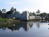 Adare Desmond CastleMedieval castle · 1.6 mi
 Franciscan AbbeyArchaeological place · 1.8 mi
 Adare Tourist OfficeVisitor information · 1.8 mi
 Clonshire CastleCastle · 3.4 mi
More archaeology and monuments in County Limerick · All of County Limerick
What do you know about this place?