
What is recorded here
Kilcurly House in Kilcurly acquired its grand limestone porch second-hand. The porch has the look of a relation who’s moved in with one suitcase and immediately started calling it ‘our family seat’.
Detached three-bay two-storey house, built c. 1840, having porch to front (east) elevation, flanking three-bay single-storey wings to north and south elevations and two-bay two-storey block to rear (west) with recent extensions. Canted bow and single-bay single-storey extension to north elevation. Hipped slate roof with rendered chimneystacks. Hipped slate roof to rear block and wings. Roughcast rendered walls. Square-headed openings having render surrounds, limestone sills and two-over-two pane timber sliding sash windows. Round-headed opening to rear block with fixed window. Oculus to rear block, south elevation having render surround and fixed window. Porch comprising limestone Doric-style engaged columns supporting entablature and carved cornice over square-headed timber panelled door. Camber-headed opening to rear block with render surround and timber panelled door. Multiple-bay single-storey outbuildings to west having hipped slate roofs and rendered chimneystacks. Roughcast rendered walls. Square-headed openings with render surrounds, concrete sills and two-over-two pane timber sliding sash windows. Square-headed openings with timber battened doors. Elliptical-headed carriage arches. Pair of rubble limestone piers to south-west having carved ball finial caps and rubble limestone walls.
This modest house displays a complex form due to later additions and periodic building phases. The original modest block was extended in the late nineteenth century, while the wings are a recent addition. The façade is enlivened by the limestone porch, which was salvaged and erected in its present position twenty five years ago. The outbuildings add context to the site, whereas the piers add artistic interest to the composition.
From the Buildings of Ireland (National Inventory of Architectural Heritage) record 21901215
This does not grant access. Most recorded buildings are privately owned; view them only from public ground unless the owner allows entry.
Places near here
Photo credits
- National Inventory of Architectural Heritage
- Malene Thyssen, Wikimedia Commons · CC BY-SA 3.0
- Sitomon, Wikimedia Commons · CC BY-SA 2.0
- John Baker, Geograph · CC BY-SA 2.0
- Adareman, Wikimedia Commons · CC BY-SA 4.0
- Peter Craine, Wikimedia Commons · CC BY-SA 2.0
- Callanmurphy, Wikimedia Commons · CC BY-SA 4.0
- Joseph Mischyshyn, Geograph · CC BY-SA 2.0
- Mike Searle, Geograph · Creative Commons Attribution-ShareAlike 2.0
Settlement cluster in Kilcurly (kenry By.)Settlement cluster · 364 yd Clorane HouseCountry house · 700 ydRic barracks978 ydKnocknagowerNamed rock · 1.4 miEuropean Beech1.5 miEuropean Yew1.5 miDesmonds Castle (in ruins)Castle, Anglo-Norman masonry castle · 1.5 miDesmond CastleHeritage attraction · 1.5 miAdare Desmond CastleMedieval castle · 1.5 miFranciscan AbbeyArchaeological place · 1.7 miAdare Tourist OfficeVisitor information · 1.8 miClonshire CastleCastle · 3.5 mi
 Clorane HouseCountry house · 700 yd
 Ric barracks978 ydKnocknagowerNamed rock · 1.4 mi
 European Beech1.5 mi
 European Yew1.5 mi
 Desmonds Castle (in ruins)Castle, Anglo-Norman masonry castle · 1.5 mi
 Desmond CastleHeritage attraction · 1.5 mi
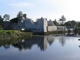 Adare Desmond CastleMedieval castle · 1.5 mi
 Franciscan AbbeyArchaeological place · 1.7 mi
 Adare Tourist OfficeVisitor information · 1.8 mi
 Clonshire CastleCastle · 3.5 mi
More historic places in County Limerick · All of County Limerick
What do you know about this place?