What is recorded here
Situated in rough grassland immediately E of Clorane House. Outline of large roughly square-shaped enclosure (approx. dims. 120m N-S x 150m E-W) visible on Google Earth photographs taken 05/02/2009. The irregularity or imprecise nature of the defining feature casts some doubt about the antiquity of this feature although the cultivation ridges contained within this enclosure appear to respect the enclosing element. See attached Google earth aerial photograph showing outline of enclosure. Rob O'Hara
Date of upload: 18 February 2020
From the National Monuments Service (Archaeological Survey of Ireland) record LI012-159
The monument record does not grant public access. Check the route and ask the landowner before entering private land.
- What survives
- Recorded monument
Places near here
Photo credits
- National Inventory of Architectural Heritage
- Malene Thyssen, Wikimedia Commons · CC BY-SA 3.0
- Sitomon, Wikimedia Commons · CC BY-SA 2.0
- John Baker, Geograph · CC BY-SA 2.0
- Adareman, Wikimedia Commons · CC BY-SA 4.0
- Peter Craine, Wikimedia Commons · CC BY-SA 2.0
- Callanmurphy, Wikimedia Commons · CC BY-SA 4.0
- Liam, Geograph · CC BY-SA 2.0
 Clorane HouseCountry house · 243 ydField system in ClorhaneField system · 510 yd
 Ric barracks556 ydKnocknagowerNamed rock · 1.4 mi
 European Beech1.8 mi
 European Yew1.8 mi
 Desmonds Castle (in ruins)Castle, Anglo-Norman masonry castle · 1.9 mi
 Desmond CastleHeritage attraction · 1.9 mi
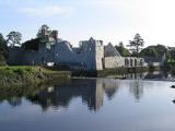 Adare Desmond CastleMedieval castle · 1.9 mi
 Franciscan AbbeyArchaeological place · 2.0 mi
 Court Castle (in ruins)Castle, tower house · 2.2 miSt James's WellSpring · 4.8 mi
More archaeology and monuments in County Limerick · All of County Limerick
What do you know about this place?