What is recorded here
A pair of trapezoidal enclosures/fields, one of which is more clearly visible on the current Google imagery (52.596244, -8.793153). This latter enclosure does appear to correspond to a smaller trapezoid marked on all three OS map editions.
From the National Monuments Service (Archaeological Survey of Ireland) record LI012-171
The monument record does not grant public access. Check the route and ask the landowner before entering private land.
- What survives
- Recorded monument
Places near here
Photo credits
- National Inventory of Architectural Heritage
- Malene Thyssen, Wikimedia Commons · CC BY-SA 3.0
- Sitomon, Wikimedia Commons · CC BY-SA 2.0
- John Baker, Geograph · CC BY-SA 2.0
- Adareman, Wikimedia Commons · CC BY-SA 4.0
- Peter Craine, Wikimedia Commons · CC BY-SA 2.0
- Callanmurphy, Wikimedia Commons · CC BY-SA 4.0
- Liam, Geograph · CC BY-SA 2.0
Field system in Kilcurly (kenry By.)Field system · 280 yd Clorane HouseCountry house · 752 ydKilcurly HouseCountry house · 800 ydKnocknagowerNamed rock · 1.7 miEuropean Beech1.8 miEuropean Yew1.8 miDesmonds Castle (in ruins)Castle, Anglo-Norman masonry castle · 1.9 miDesmond CastleHeritage attraction · 1.9 miAdare Desmond CastleMedieval castle · 1.9 miFranciscan AbbeyArchaeological place · 2.0 miCourt Castle (in ruins)Castle, tower house · 2.0 miSt James's WellSpring · 4.6 mi
 Clorane HouseCountry house · 752 yd
 Kilcurly HouseCountry house · 800 ydKnocknagowerNamed rock · 1.7 mi
 European Beech1.8 mi
 European Yew1.8 mi
 Desmonds Castle (in ruins)Castle, Anglo-Norman masonry castle · 1.9 mi
 Desmond CastleHeritage attraction · 1.9 mi
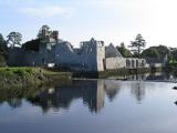 Adare Desmond CastleMedieval castle · 1.9 mi
 Franciscan AbbeyArchaeological place · 2.0 mi
 Court Castle (in ruins)Castle, tower house · 2.0 miSt James's WellSpring · 4.6 mi
More archaeology and monuments in County Limerick · All of County Limerick
What do you know about this place?