What is recorded here
Three terraced areas running from E-W are defined by four linear or sinuous earthworks (approx. L. 170m E-W; Wth 40m) or lynchets of possible medieval date although this dating is uncertain. The curving nature of the lynchets along with the curving or sinuous form of the field boundary to N may indicate that these earthworks represent the remains of medieval cultivation. Situated in field immediately E of two enclosures (LI012-153--/152-) and one ringfort (LI012-130----) which are visible on Google earth aerial photograph taken 05/02/2009 may be the remains of a medieval settlement. A children's burial ground (LI012-069----) lies 240m to S, with the site of a medieval chapel (LI012-068----) 480m to SW. Earthworks (LI012-151----) 730m to SW may be the remains of a substantial dwelling depicted on the 1657 Down Survey map. The lynchets possibly represents the remains of medieval cultivation associated with the medieval chapel (I012-068---) of 'Kilkerill' [Cill Choireallaigh/Kilcurley] which is shown standing beside a substantial dwelling with a second building to S that are depicted on the 1657 Down Survey map of Kenry Barony (NLI, MS 718). The ridge and furrow ridges visible on Google earth aerial photographs may represent the remains of post-1700 field systems. The lands of Kilcurly were described in a land grant of 1587 when they were described as containing 'In Kilcoill, alias Kill Kryle, 3 Messuages, 2 Cottages, 24a. arable, 6a. pasture, & underwood, and the foundation of a Watermill [LI012-150----], & other lands containing ½ a Plowland' (Dunraven 1865, 253). See attached Google earth aerial photograph taken 05/02/2009 showing lynchets running across the field in an E-W direction. Rob O'Hara Date of upload: 18 February 2020
Three terraced areas running from E-W are defined by four linear or sinuous earthworks (approx. L. 170m E-W; Wth 40m) or lynchets of possible medieval date although this dating is uncertain. The curving nature of the lynchets along with the curving or sinuous form of the field boundary to N may indicate that these earthworks represent the remains of medieval cultivation. Situated in field immediately E of two…
From the National Monuments Service (Archaeological Survey of Ireland) record LI012-154
The monument record does not grant public access. Check the route and ask the landowner before entering private land.
- What survives
- Recorded monument
Places near here
Photo credits
- National Inventory of Architectural Heritage
- Malene Thyssen, Wikimedia Commons · CC BY-SA 3.0
- Sitomon, Wikimedia Commons · CC BY-SA 2.0
- John Baker, Geograph · CC BY-SA 2.0
- Adareman, Wikimedia Commons · CC BY-SA 4.0
- Peter Craine, Wikimedia Commons · CC BY-SA 2.0
- Callanmurphy, Wikimedia Commons · CC BY-SA 4.0
- Liam, Geograph · CC BY-SA 2.0
Enclosure in Kilcurly (kenry By.)Enclosure · 170 yd Kilcurly HouseCountry house · 678 ydClorane HouseCountry house · 881 ydEuropean Beech1.7 miEuropean Yew1.7 miKnocknagowerNamed rock · 1.7 miDesmonds Castle (in ruins)Castle, Anglo-Norman masonry castle · 1.7 miDesmond CastleHeritage attraction · 1.7 miAdare Desmond CastleMedieval castle · 1.7 miFranciscan AbbeyArchaeological place · 1.8 miCourt Castle (in ruins)Castle, tower house · 2.1 miSt James's WellSpring · 4.6 mi
 Kilcurly HouseCountry house · 678 yd
 Clorane HouseCountry house · 881 yd
 European Beech1.7 mi
 European Yew1.7 miKnocknagowerNamed rock · 1.7 mi
 Desmonds Castle (in ruins)Castle, Anglo-Norman masonry castle · 1.7 mi
 Desmond CastleHeritage attraction · 1.7 mi
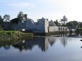 Adare Desmond CastleMedieval castle · 1.7 mi
 Franciscan AbbeyArchaeological place · 1.8 mi
 Court Castle (in ruins)Castle, tower house · 2.1 miSt James's WellSpring · 4.6 mi
More archaeology and monuments in County Limerick · All of County Limerick
What do you know about this place?