Places near here
Photo credits
- jule_berlin, Wikimedia Commons · CC BY 2.0
- NateBergin, Wikimedia Commons · CC BY 4.0
- National Inventory of Architectural Heritage
- Mike Searle, Wikimedia Commons · CC BY-SA 2.0
- C O'Flanagan, Wikimedia Commons · CC BY-SA 2.0
- Taco van der Waal, Wikimedia Commons · CC BY-SA 3.0
- Didier Descouens, Wikimedia Commons · CC BY-SA 4.0
- Wanfried-Dublin, Wikimedia Commons · CC BY 4.0
 Quin AbbeyHeritage attraction · 56 yd
Explorer Tom Quin Abbey is a medieval wonder in County Clare, where time has worn the stones but not the stories within its walls.
 Quin Abbey ( in ruins)Religious house, Franciscan friars · 57 yd
Explorer Tom Quin Abbey (in ruins) in Quin does its best impression of a haunted house when nobody's looking. Make a wish, it's had centuries of practice.
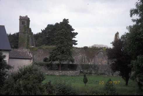 Saint Fineen's ChurchChurch/chapel · 186 yd
Explorer Tom Saint Fineen's Church in Quingardens is playing hard to get, ruined since 1878 after Thomas de Clare got grumpy. It’s just a lonely tower now, probably ignoring me on purpose. Bring a camera and your most suspicious face.
 Danganbrack Castle (in Ruins)Castle, tower house · 894 yd
Explorer Tom Danganbrack Castle is covered in ivy like it's trying to cosplay as a garden gnomes' clubhouse. There's definitely a dog in charge of the front gate. Bring a camera and your most suspicious face.
 Ballymarkahan Castle (in Ruins)Castle, tower house · 1.5 mi
Explorer Tom Ballymarkahan Castle in County Clare is playing hard to get, which is typical for a tower house with no public access. I reckon it's hiding in the hedgerows, laughing at my boots. Best visited with a curious kid and no timetable.
 Magh AdhairArchaeological place · 2.1 mi
Explorer Tom Magh Adhair was the inauguration place of Thomond Kings, so you can almost feel the weight of that history.
 Mooghaun HillfortArchaeological place · 2.6 mi
Explorer Tom Mooghaun Hillfort: an ancient stronghold where history and nature stand as one
Mooghaun WoodsWood · 2.7 miExplorer Tom Mooghaun Woods in County Clare stands quietly on the map, waiting for curious feet to wander through its leafy depths.
Cloghleagh RockNamed rock · 3.0 miExplorer Tom Cloghleagh Rock is a named rock in County Clare, likely standing proud against the crashing Atlantic tides.
 Hawthorn3.2 mi
Explorer Tom Hawthorn that looks like it's waiting for its turn in line for the pub. Go on, count the windows and get it wrong like I did.
 Giants GraveWedge tomb · 4.1 mi
Explorer Tom Giants Grave in Ballyslattery is defined by orthostats, which sounds like a medical condition but is actually just upright stones being dramatic. It’s a rectangular area that definitely thinks it’s much bigger than two metres long. Take a mate and argue about what it was for.
G.A.A. Commemorative StoneMemorial · 4.4 miExplorer Tom G.A.A. Commemorative Stone is a tribute to the past, marking the legacy of the GAA in County Clare's history.
More historic places in County Clare · All of County Clare

What do you know about this place?Tap to add a comment or ask a question