
What is recorded here
Savage Bridge near Killashee announces itself on a carved name plaque, then offers you a gentle canal arch and politely curved stone walls. It's a man introducing himself as The Destroyer before asking whether you'd like the crusts cut off.
Single-arch humpbacked canal bridge carrying road over Royal Canal, built c. 1817. Round/elliptical-headed arch with dressed limestone voussoirs and ashlar limestone walls. Cut limestone string course at road level. Dressed limestone parapets with curving ends terminated in dressed limestone piers (on square-plan). Carved name plaque to parapet wall. Tow path to the west side with dressed limestone kerbing. Located to the northeast of Killashee.
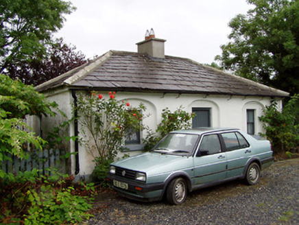
A typically well-built canal bridge, which is a valuable part of the architectural and industrial heritage of County Longford. Although humble in form, this structure has a simple and functional elegance. It is robustly built in fine stone masonry, which is testament to the long-term ambitions of the Royal Canal Company at the start of the nineteenth century. It was probably built to designs by John Killaly (1766 – 1832), the engineer responsible for the construction of this part of the Royal Canal. This bridge forms part of a group of canal structures to the northeast of Killashee, along with the lock (13311007) and the associated lock keeper’s house (13311005) and is an integral element of the built heritage of County Longford.
From the Buildings of Ireland (National Inventory of Architectural Heritage) record 13311006
This does not grant access. Most recorded buildings are privately owned; view them only from public ground unless the owner allows entry.
Places near here
Photo credits
- Royalcanalrunner, Wikimedia Commons · CC BY-SA 4.0
- National Inventory of Architectural Heritage
- 瑞丽江的河水, Wikimedia Commons · CC BY-SA 4.0
- Mike Searle, Geograph · CC BY-SA 2.0
- Kieran Campbell, Geograph · CC BY-SA 2.0
- AndreasDelp, Wikimedia Commons · CC BY-SA 4.0
- David Baird, Geograph · CC BY-SA 2.0
- Alvesgaspar, Wikimedia Commons · CC BY-SA 3.0
- Algirdas at Lithuanian Wikipedia, Wikimedia Commons · Public domain
- AmandaMcCrann, Wikimedia Commons · CC BY-SA 4.0
 44th LockLock · 19 yd
 44th LockLock keeper's house · 33 ydEnclosure in SharvogeEnclosure · 984 yd
 First World War MemorialMemorial · 4.1 mi
 Saint Mel's CathedralCathedral · 4.3 mi
 Rathcline CastleHouse, fortified house · 5.6 mi
 Rathcline CastleBawn · 5.6 mi
 InchcleraunIsland · 9.0 mi
 Leveret IslandIslet · 10 mi
 Common Lime11 mi
 Pedunculate Oak11 mi
 Cloghogle StonePassage tomb · 14 mi
More historic places in County Longford · All of County Longford
What do you know about this place?