
What is recorded here
Situated on top of Knockbarron Hill, in an area of undulating countryside. On the 1838 ed. OS 6-inch map the well is shown standing inside a woodland which is shown as Knockbarron Wood ont he 1908 ed. OS map. Poorly preserved well now dry with no other features visible. According to Purser (1918, 77) a local pattern was held here on St. John's Eve. St John's Rock (OF036-027----) which was used as a mass rock is located 125m to the NE. In 1934 the National Schools Survey of Holy Wells recorded that there was in a wood in the vicinity of Drumcullen monastery (now in ruins) (OF036-028001-), on a prominent hill, overlooking Kinnitty village and district. Ash tree growing out of side of well, crude steps descending to well. Well in a cavity, no protection around, some briars and shrubbery’ (NFC 468, 140). The survey recorded that a pilgrimage to this site occurred on the 24th of June for 9 days, ‘ending with a pattern; but of late years the pattern and bonfire are celebrated on 29th June’ (ibid.). The devotion at the well or pattern consisted of ‘three rounds, each round consisted of 3 Our Fathers and 3 Hail Marys, in clock [wise] direction; also prayers at Mass Rock (OF036-027----) nearby’ (ibid.). The water was used generally to cure ailments but had no special powers for any specific ailment. Votive offerings were left behind at the well including medals, pennies, bits of ribbons, beads etc. These offerings were placed on the sides of the well and on branches of the trees around the well. The votive offerings on the branches of the trees were placed here during the days of November.
The above description is derived from the published 'Archaeological Inventory of County Offaly' (Dublin: Stationery Office, 1997). In certain instances the entries have been revised and updated in the light of recent research.
Compiled by: Caimin O'Brien
Date of upload/revision: 18 December 2013
Linked to Saint John the Baptist, the well is traditionally associated with healing and protection, with customs often observed around the summer solstice. Historical woodland settings suggest a long-standing sacred landscape, possibly incorporating pre-Christian elements into later Christian practice.
The monument record does not grant public access. Check the route and ask the landowner before entering private land.
- What survives
- Recorded monument
Places near here
 Saint Johns RockRitual site, holy/saint's stone · 145 yd
 Knockbarron WoodForest · 807 yd
 Drumcullen Church in ruinsChurch · 1103 yd
 CrossCross, High cross · 1106 yd
 CastleCastle, tower house · 1381 yd
 Bawn in Annaghmore AND AnnaghbegBawn · 1397 yd
 Moneyguyneen WoodWood · 1.0 mi
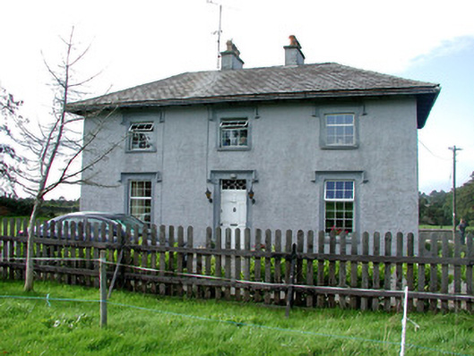 Glenviewhouse · 1.1 mi
 Waypoint 1Visitor information · 1.4 mi
 Castletown and GlinskVisitor information · 1.5 mi
 Kinnitty Castle LoopWalking route · 1.9 mi
 KnocknamanMountain / peak · 2.5 mi
Other information
Photo: Credit not shown in the picture search · Rights wording not checked; contact us if this picture should be removed