Places near here
Photo credits
- National Inventory of Architectural Heritage
- Alvesgaspar, Wikimedia Commons · CC BY-SA 3.0
- Malene Thyssen, Wikimedia Commons · CC BY-SA 3.0
- Golfing in Ireland; photographer not stated, Source publisher
- Mike Searle, Geograph · CC BY-SA 2.0
- James Allan, Wikimedia Commons · CC BY-SA 2.0
- Kmcnamee, Wikimedia Commons · CC BY-SA 4.0
- Paul Mc Carthy, Geograph · Creative Commons Attribution-ShareAlike 2.0
- Robin Pollard, Wikimedia Commons · CC BY 3.0
- John M, Wikimedia Commons · CC BY-SA 2.0
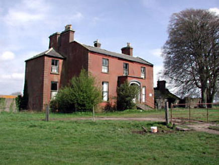 Castlerickard HouseCountry house · 1.8 mi
Explorer Tom Castlerickard House in Castlerickard, County Meath is probably hosting a secret feud between two families over who owns…
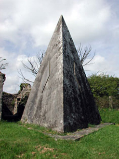 Saint Nicholas's Church (Castlerickard)Mausoleum · 1.9 mi
Explorer Tom Saint Nicholas's Church (Castlerickard) is playing dress-up as a mausoleum with diagonal bricks for no reason. It gave…
 Common Lime2.3 mi
Explorer Tom Common Lime in County Meath once hid a crate of smuggled whiskey in its roots during a particularly rainy century. The…
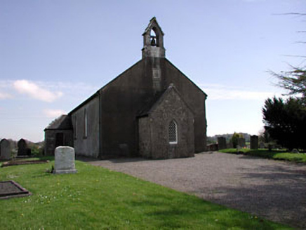 Saint Ultan's Church (Rathcore)Church/chapel · 2.4 mi
Explorer Tom Saint Ultan’s Church (Rathcore) is having a real bit with me. All that fancy ashlar and traceried windows? Just trying…
 European Beech2.4 mi
Explorer Tom European Beech in County Meath is sick of people asking if it talks to the other trees; yes, they gossip, shut up. It’s…
 Rathcore Golf ClubGolf course · 2.5 mi
 CastleCastle, tower house · 2.9 mi
Explorer Tom Castle in Donore is playing hide-and-seek with me, but I think it’s hiding behind its own ego. A local claims he…
 Donore CastleCastle · 2.9 mi
Explorer Tom Donore Castle is in a bitter feud with the next village over something as daft as a missing fence post. They’ve stopped…
 Longwood GAAGAA ground · 3.0 mi
 Grave YardGraveyard · 5.6 mi
Explorer Tom Graveyard in Cloncurry nearly got famous when someone tried to digitize its records in the nineties, but the internet…
 Croppies' GraveMemorial · 5.9 mi
Explorer Tom Croppies' Grave marks where rebels fell, and someone wrote a terrible poem about it that rhymed 'blood' with 'mud'. The…
 Wellington MonumentMonument · 5.9 mi
Explorer Tom Wellington Monument in County Meath would spend its lotto win on an extremely fancy hat for its statue head. It’s got…
More historic places in County Meath · All of County Meath

What do you know about this place?Tap to add a comment or ask a question