
What is recorded here
From OpenStreetMap (© OpenStreetMap contributors) n5677752036
Places near here
Photo credits
- Corinna Schleiffer, Wikimedia Commons · CC BY-SA 2.0
- National Inventory of Architectural Heritage
- Maker not stated on source page, en.wikipedia.org
- Maker not stated on source page, www.pinterest.com
- Maker not stated on source page, www.heritagedaily.com
- Kenneth Allen, Wikimedia Commons · CC BY-SA 2.0
- Kenneth Allen, Geograph · CC BY-SA 2.0
- Maker not stated on source page, www.tripadvisor.ie
- Oliver Dixon, Wikimedia Commons · CC BY-SA 2.0
- Richard Webb / Geograph Ireland, www.geograph.ie
- Maker not stated on source page, ru.pinterest.com
 CrockavishaneMountain / peak · 1.0 mi
Explorer Tom Crockavishane in Donegal is having a very fancy lunch experience that costs nothing but your dignity. It’s all about…
 bridge1.8 mi
Explorer Tom Aghaglassan's bridge carries one narrow road over three square openings roofed by enormous flat stone lintels. It is…
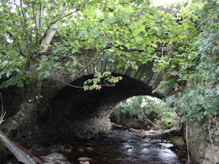 Ballintroohan BridgeBridge · 1.9 mi
Explorer Tom Ballintroohan Bridge has been taking the traffic since c. 1800, proving that simple masonry skills can stand the test…
 Megalithic tomb in AghaglassanMegalithic tomb · 1.9 mi
Explorer Tom Megalithic tomb in Aghaglassan is supposedly a giant’s grave ringed by stones, but nobody can actually find it. The…
 Standing stone in Ballylawn (castlecary Ed)Standing stone · 1.9 mi
Explorer Tom Standing stone in Ballylawn was removed in 1942, leaving behind nothing but a record of its former presence. It is a…
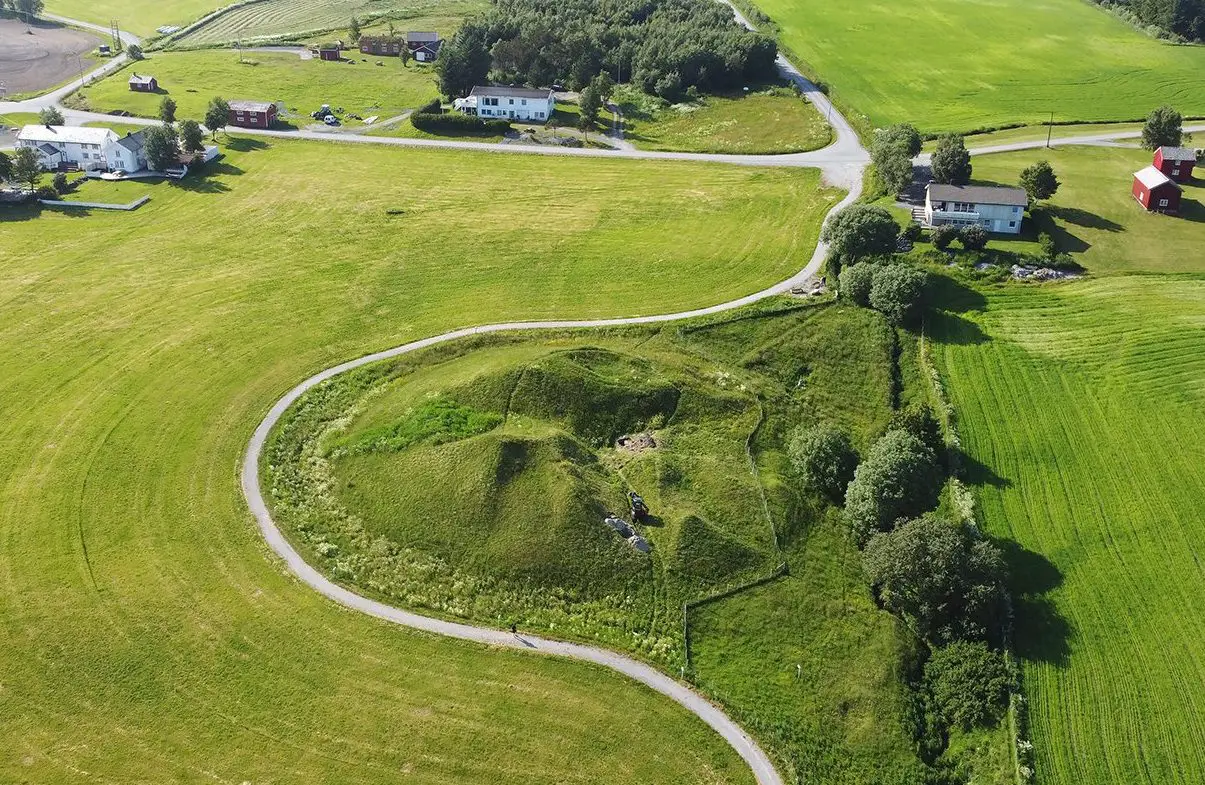 Burial mound in MovilleBurial mound · 2.0 mi
Explorer Tom Burial mound in Moville is officially just a recorded tumulus, but the real treasure here is the gossip about what’s…
 CroaghmoreMountain / peak · 2.2 mi
Explorer Tom Croaghmore in County Donegal would win a county fair easily, simply by standing still and looking vaguely impressive…
 Orchard BarPub · 2.8 mi
Explorer Tom Orchard Bar in County Donegal has an unlikely celebrity friend who only visits when the cider is fresh. I’d bet they…
 Redcastle Oceanfront Golf & Spa HotelHotel · 3.0 mi
Explorer Tom Redcastle Oceanfront Golf & Spa Hotel claims oceanfront status, which is generous for Donegal's rough coastline where…
 Bath GreenPark · 4.0 mi
Explorer Tom Bath Green spreads beside Lough Foyle in Moville, with a shore walk that makes this little Donegal town feel much wider…
 Carrick Field, Moville GAAGAA ground · 4.4 mi
 Mapped graveyardGraveyard · 4.9 mi
Explorer Tom Mapped graveyard in County Donegal is where a Viking got so drunk he buried his sword next to a turnip by accident. He…
More mountains and hills in County Donegal · All of County Donegal

What do you know about this place?Tap to add a comment or ask a question