What is recorded here
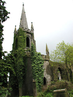
A castle at Kilskyre (53) in Kilskyre parish and Kells barony is marked as a tower on the Down Survey (1656-8) barony and parish maps adjacent to the church (http://downsurvey.tcd.ie/). According to the Civil Survey (1654-6) the Earl of Fingal and Henry Plunkett of Hartstown in Killallon parish owned 325 acres at Kilskyre, Villenaghtownme, Millstowne and Cullinstowne, which are all sub-denominations of Kilskyre, in 1640 (Simington 1940, 301). It is situated on a slight rise in a fairly level landscape within the ecclesiastical enclosure (ME016-043005-) and c. 30m SW of the parish church (ME016-044----). Only the ivy-covered NW corner of what was once probably a tower house survives to three storeys with no identifiable architectural features.
A castle at Kilskyre (53) in Kilskyre parish and Kells barony is marked as a tower on the Down Survey (1656-8) barony and parish maps adjacent to the church (http://downsurvey.tcd.ie/). According to the Civil Survey (1654-6) the Earl of Fingal and Henry Plunkett of Hartstown in Killallon parish owned 325 acres at Kilskyre, Villenaghtownme, Millstowne and Cullinstowne, which are all sub-denominations of Kilskyre,…
From the National Monuments Service (Archaeological Survey of Ireland) record ME016-042
The monument record does not grant public access. Check the route and ask the landowner before entering private land.
- What survives
- Recorded monument
Places near here
Photo credits
- National Inventory of Architectural Heritage
- Bob Embleton, Geograph · CC BY-SA 2.0
- Willow, Wikimedia Commons · CC BY 2.5
- Kieran Campbell, Geograph · Creative Commons Attribution-ShareAlike 2.0
- Didier Descouens, Wikimedia Commons · CC BY-SA 4.0
- Bill Griffiths, Wikimedia Commons · CC BY-SA 2.0
- Haydn Hammerton, Wikimedia Commons · CC BY-SA 4.0
 Saint Schiria's Church (Kilskeer)Church/chapel · 1.8 mi
 Killua CastleGate lodge · 1.8 miCloncatMountain / peak · 2.1 mi
 Standing stone in Balnagon UpperStanding stone · 2.3 mi
 European ash2.6 miCastleCastle, unclassified · 2.8 mi
 Grave YardGraveyard · 3.0 miBoglandMemorial · 3.1 mi
 Hawthorn3.7 mi
 Earthen TumulusCastle, motte · 5.0 mi
 Slieve Na CalliaghMountain / peak · 5.9 mi
 Loughcrew Megalithic TombsHeritage attraction · 6.0 mi
More castles and forts in County Meath · All of County Meath
What do you know about this place?