What is recorded here
Kellistown East lost its round tower before the nineteenth century, leaving only ruins for sketchers and a church belfry built above the forgotten foundation. The transfer of height from pagan marker to Christian bell may have felt like justice to the men who hammered the new stone, or like theft to the ghosts who watched. Either way, the tower stopped being a tower and became a room for noise, its old purpose buried under the weight of ceremony.
The Anthologia Hibernica (Vol. IV., p. 105 July - December 1794) contains a sketch of a Round Tower in ruins at Kellistown (JKAS 1933, 271-7). A drawing by J. Saunders TCD, believed to date to c. 1797 also depicts the round tower in ruins. The OS Letters (O' Flanagan 1934, 44) note that the Belfry of the chuch (CW008-038001-) was built where the round tower stood.
Reference:
O' Flanagan, E. (typescript) 1934 Letters containing information relative to the Antiquities of the County of Carlow collected during the progress of the Ordnance Survey in 1839.
Compiled by: Claire Breen
Date of upload: 19 August 2011
The monument record does not grant public access. Check the route and ask the landowner before entering private land.
- What survives
- Recorded monument
Places near here
 Font in Kellistown EastFont · 1 yd
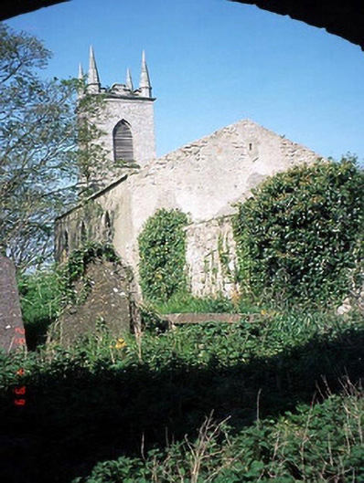 Saint Patrick's Church (Kellistown)church/chapel · 16 yd
 Kellistown ChurchRuins · 17 yd
 Enclosure in Kellistown EastEnclosure · 760 yd
 Site of CastleCastle, unclassified · 1218 yd
 Kilmurry Church (in ruins), GraveyardChurch · 1.1 mi
 Ballynunnery Castle in ruinsCastle, unclassified · 1.4 mi
 Church (in ruins), GraveyardChurch · 2.4 mi
 Brownshill Portal TombVisitor information · 3.6 mi
 Duckett's GroveHeritage attraction · 4.6 mi
 Cork oakCork oak · 4.7 mi
 European YewEuropean Yew · 4.8 mi