
What is recorded here
From the Northern Ireland Sites and Monuments Record record FER258:001
Places near here
Photo credits
- Maker not stated on source page, tr.pinterest.com
- Colin Park, Wikimedia Commons
- Colin Park, Geograph · CC BY-SA 2.0
- Maker not stated on source page, www.pinterest.de
- Maker not stated on source page, commons.wikimedia.org
- Kenneth Allen, Geograph · CC BY-SA 2.0
- National Inventory of Architectural Heritage
- Maker not stated on source page, www.tripadvisor.ie
- Maker not stated on source page, www.dreamstime.com
- Maker not stated on source page, storage.googleapis.com
 CairnCairn, unclassified · 3 yd
Explorer Tom Cairn in Alteen has an escape plan involving rolling down the mountain and hiding under a bus. It commemorates…
 CuilcaghMountain / peak · 27 yd
Explorer Tom Cuilcagh rises on the Fermanagh and Cavan border above blanket bog and a steep boardwalk staircase. People call the…
 Cuilcagh WayWalking route · 1202 yd
Explorer Tom Cuilcagh Way would spend its lotto win on buying every single pair of wellies ever made. It winds up the mountain like…
 Corracleigh ForestForest · 2.2 mi
Explorer Tom Corracleigh Forest is hiding something big behind those trees. I bet it’s got a secret talent for playing hide-and-seek…
 Round cairn: laght A phelim in KillykeeghanRound Cairn: Laght A Phelim · 2.3 mi
Explorer Tom Round cairn: laght A phelim in Killykeeghan is named after Phelem, who probably owed money to half the county and hid…
 Monydoo or TonycromMountain / peak · 2.4 mi
Explorer Tom Monydoo or Tonycrom is the awkward uncle at the wedding, always wearing the wrong outfit and stealing bites of the…
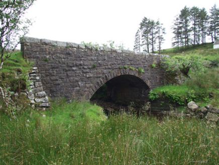 Commas BridgeBridge · 2.5 mi
Explorer Tom Commas Bridge is named after punctuation marks, which means it's probably arguing with the river about grammar. It's…
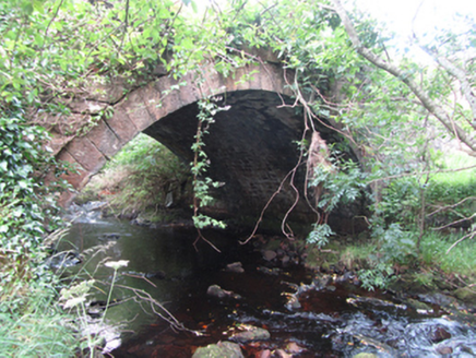 Carty’s BridgeBridge · 2.8 mi
Explorer Tom Carty’s Bridge is an elegant arch that probably thinks it’s too fancy for the mud. I heard a fiddler played on it all…
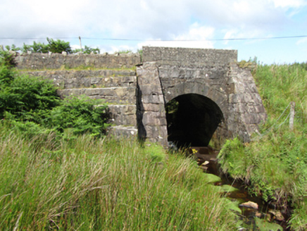 bridge2.9 mi
Explorer Tom Bridge in Altachullion Lower, County Cavan: Robust cut stone with a waterfall nearby. Locals swear there’s a tunnel to…
 Sulphur Spa WellSpring · 3.2 mi
Explorer Tom Sulphur Spa Well in County Cavan smells exactly like a gym sock left in the sun. I love it, honestly, it reminds me of…
 Tully ForestForest · 4.1 mi
Explorer Tom Tully Forest in County Cavan had a prophecy that said it would turn into gold, but it just ended up looking extra shiny…
 Fairy fort / stone ringfort in Garvalt LowerFairy fort / stone ringfort · 4.3 mi
Explorer Tom Fairy fort / stone ringfort in Garvalt Lower is lost in the woods like a tourist without a map. The stones are probably…
More archaeology and monuments in County Fermanagh · All of County Fermanagh

What do you know about this place?Tap to add a comment or ask a question