Places near here
Photo credits
- National Inventory of Architectural Heritage
- Carl Meehan, Wikimedia Commons · CC BY 2.0
- Colin Park, Geograph · CC BY-SA 2.0
- Kenneth Allen, Geograph · CC BY-SA 2.0
- Gerard Lovett from ireland, Wikimedia Commons · CC BY 2.0
- Kenneth Allen, Wikimedia Commons · CC BY-SA 2.0
- National Library of Ireland on The Commons; photograph by Thomas H. Mason, Wikimedia Commons · No known copyright restrictions
- N Chadwick, Geograph · CC BY-SA 2.0
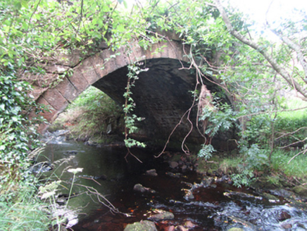 Carty’s BridgeBridge · 979 yd
Explorer Tom Carty’s Bridge is an elegant arch that probably thinks it’s too fancy for the mud. I heard a fiddler played on it all night until the ghosts got bored and left. Listen for the music as you pass.
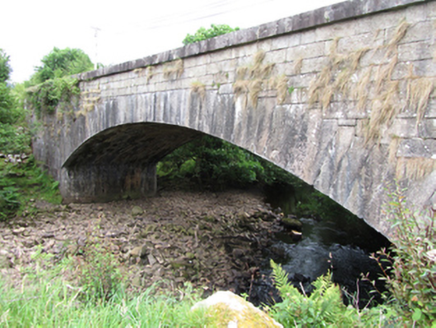 bridge1.9 mi
Explorer Tom Bridge in Gub or Garvalt Upper has an elegant arch and expertly cut ashlar. It was built with a big road project in mind. Ask it what it thinks of the potholes leading to its entrance.
 CuilcaghMountain / peak · 2.2 mi
Explorer Tom This other Cuilcagh has an unlikely celebrity friend who is just a very confused cloud that gets stuck on top every Friday. It pretends to be famous because of this association. Look for the ghost, then pretend you didn't.
 Cuilcagh WayWalking route · 2.8 mi
Explorer Tom Cuilcagh Way would spend its lotto win on buying every single pair of wellies ever made. It winds up the mountain like a snake that wants a hug from you. Grand place for a sulk or a snog, your call.
 Tullydermot FallsWaterfall · 3.6 mi
Explorer Tom Tullydermot Falls in County Cavan is being picked on by the wind because it won't stop splashing everywhere. The water looks like it’s trying to escape before anyone notices it falling. Find the date carved somewhere and feel clever.
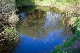 Shannon PotSpring · 4.2 mi
Explorer Tom The Shannon begins with a pool in Cavan that looks far too modest for Ireland's longest river. Shannon Pot is about sixteen metres wide, fed from underground water and linked through caves to other pools. Divers reached a depth of 14.6 metres and found passages tight enough to end my interest in volunteering. A poem from around 1349 already called it the source of the Shannon. Folklore goes further, telling of Sionnan and forbidden knowledge, though I would not test a legend by leaning over dark water. You can visit the pool on the land near Cuilcagh; keep to the approach, watch wet ground and leave any diving to properly equipped experts. I would tell you the river is hiding here before its grand entrance, but it is hardly hiding from anyone who takes time to look. Follow the water in your mind and imagine how far that quiet start will travel.
Síonnan and the Salmon: Shannon PotLegend location · 4.2 miExplorer Tom Síonnan and the Salmon: Shannon Pot has a curious woman chasing the Salmon of Wisdom and a pool that responds by overflowing into a river. That is a lot of water for one question. I would take a notebook, but I would keep it well above the edge.
 Monydoo or TonycromMountain / peak · 4.4 mi
Explorer Tom Monydoo or Tonycrom is the awkward uncle at the wedding, always wearing the wrong outfit and stealing bites of the canapés. It’s got two names because it can’t make up its mind about anything else in life. Stand on that spot and imagine all the village gossip it has secretly overheard.
 Sweat HouseSweathouse · 5.1 mi
Explorer Tom Sweat House in Legeelan is tiny enough to make you feel like a sardine in a tin of history. It’s got a chimney, so I assume they sweated while smoking. Bring biscuits; every good story needs biscuits.
 IndicatedFairy fort / stone ringfort · 5.2 mi
Explorer Tom Fairy fort or stone ringfort in Moneygashel has seven steps built into the wall and blocked-up internal staircases, looking like it’s trying to hide its secrets from prying eyes. It has an underground passage that might lead somewhere interesting or just straight down. Tell the next person you meet it's haunted. It might be.
 Gortalughany ViewpointViewpoint · 5.2 mi
Explorer Tom Gortalughany Viewpoint is playing hard to get, sitting pretty over Lough Erne while I pretend I know every potato it’s secretly proud of. It’s basically a hill that thinks it’s a fancy restaurant for clouds. Bring a notebook and write the bit I made up.
 Cuilcagh Mountain ViewpointVisitor information · 5.3 mi
Explorer Tom Cuilcagh Mountain Viewpoint is playing hard to get, claiming a rainbow is its only valid passport stamp. The hero who saved it? A man named Brian who got lost and pointed us the right way anyway. Ten minutes here and you'll have a yarn for the pub.
More woods, forests and old trees in County Cavan · All of County Cavan

What do you know about this place?Tap to add a comment or ask a question