What is recorded here
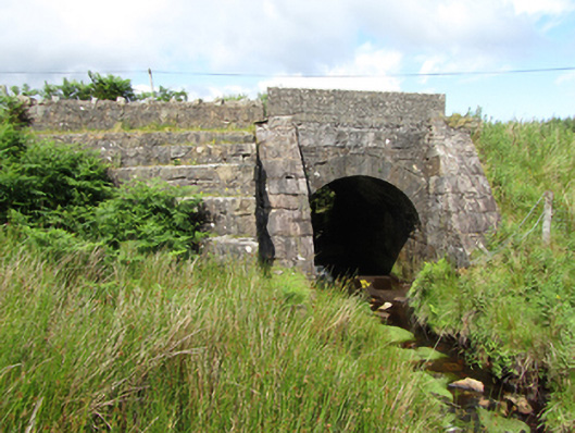
Single-arch limestone road bridge, built c.1850, spanning a watercourse. Squared ashlar abutments extending forward to form retaining walls to road embankment terminating as battered buttresses rising to base of parapet. Semi-circular arch barrel having arch ring of even punched ashlar voussoirs. Squared rubble spandrel between buttresses. Stepped rubble stone retaining wall parallel to road adjoinung south-west buttress. Concrete parapet to south, concrete block parapet to north.
A modest bridge of robust character in a highly visible upland location with a waterfall located close to the south. It is an excellent example of nineteenth century civil engineering, using well worked cut stone formed to suit the specific location, in this instance a high road embankment supported by angled buttresses and retaining walls. It is an eyecatching feature in the landscape and adds significantly to the character of its setting.
From the Buildings of Ireland (National Inventory of Architectural Heritage) record 40400604
This does not grant access. Most recorded buildings are privately owned; view them only from public ground unless the owner allows entry.
Places near here
 Tullydermot FallsWaterfall · 1308 yd
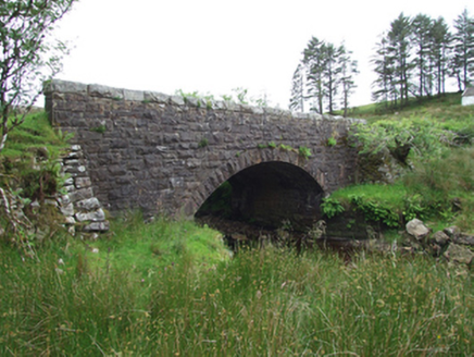 Commas BridgeBridge · 1358 yd
 Monydoo or TonycromMountain / peak · 2.5 mi
 St Patrick’s Roman Catholic ChurchChurch/chapel · 2.6 mi
 CuilcaghMountain / peak · 2.9 miProspect BayBay · 3.1 miOut-Doors and DirtyHeritage attraction · 3.1 mi
 Cuilcagh WayWalking route · 3.3 mi
 Gortalughany ViewpointViewpoint · 4.2 mi
 BenaughlinMountain / peak · 5.2 mi
 European Beech6.2 mi
 Sycamore6.2 mi
Pictures: Kenneth Allen, Geograph · CC BY-SA 2.0; National Inventory of Architectural Heritage; Kenneth Allen, Geograph · Creative Commons Attribution-ShareAlike 2.0; Carl Meehan, Wikimedia Commons · CC BY 2.0; Colin Park, Geograph · CC BY-SA 2.0; Gareth Buchanan, Geograph · CC BY-SA 2.0; Malene Thyssen, Wikimedia Commons · CC BY-SA 3.0; Christian Pirkl, Wikimedia Commons · CC BY-SA 3.0 at
More historic places in County Cavan · All of County Cavan
What do you know about this place?