What is recorded here
From OpenStreetMap (© OpenStreetMap contributors) n3077522024
Places near here
Photo credits
- National Inventory of Architectural Heritage
- Rossographer, Geograph · CC BY-SA 2.0
- Kenneth Allen, Geograph · CC BY-SA 2.0
- Ross, Wikimedia Commons · CC BY-SA 2.0
- Kenneth Allen, Wikimedia Commons · CC BY-SA 2.0
- Wanfried-Dublin, Wikimedia Commons · CC BY-SA 4.0
- David Baird, Wikimedia Commons · CC BY-SA 2.0
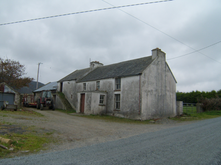 farm house1162 yd
Explorer Tom Farm house in Magheramenagh has a side wing that’s actually taller than the main house. I reckon the farmer built it so he could see over the hedge without getting up from his chair.
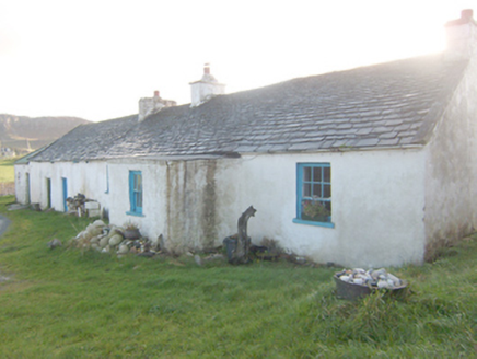 The RockHouse · 1.2 mi
Explorer Tom The Rock in Corcreggan, built circa 1820, has a flat-roofed entrance porch added around 1900 and Roshine slate roofing.
 The Carriage HotelHotel · 1.2 mi
Explorer Tom The Carriage Hotel in County Donegal is literally an old train car. Sleep on the rails, baby! Bring me a ticket stub if you find one!
 Corcreggan MillHostel · 1.2 mi
Explorer Tom Corcreggan Mill in County Donegal has yurts! Sleeping in a tent that pretends to be a house? Love it.
 Local Wildlife presentationVisitor information · 1.4 mi
Explorer Tom The Local Wildlife presentation at New Lake is hand-painted, though the peeling paint adds a certain rustic charm to the scene.
 Kill Old Church GraveyardGraveyard · 2.1 mi
Explorer Tom Kill Old Church Graveyard is roughly 50 by 25 metres, with its church in the northern part. A 1622 report called that church newly rebuilt and well repaired; it remained in use until a new one was built at Ballymore in 1752. I enjoy the change in viewpoint: the same place can be 'newly' repaired in one document and old church on this map.
 Tramore StrandBeach / strand · 2.4 mi
Explorer Tom There are two Tramore Strands in Donegal, and this one near Dunfanaghy makes you earn the sand. The local guide sends you along a tree-lined path for about 30 minutes before the two-mile beach shows itself. I would give it a grand entrance; the dangerous currents mean my swimming trunks can stay in the bag.
 Faymore DolmenNamed dolmen · 2.4 mi
Explorer Tom Faymore Dolmen sits right on the roadside with its big capstone perched proudly on upright stones. I can’t find an official number for it, but seeing that massive rock balanced there makes me wonder what story it’s keeping to itself.
 Ards Forest ParkForest recreation place · 2.5 mi
Explorer Tom Ards Forest Park puts four ringfort remains, a holy well and a Mass rock among walks that also reach salt marsh and sand dunes. Ancient stones and sea air make a rather full day here.
 Dermot and Granias BedPortal tomb · 2.7 mi
Explorer Tom Dermot and Granias Bed is a pretty ruinous portal tomb, mostly just two stones standing up in the grass. It’s named after a couple who supposedly slept here, which is either very romantic or just really lazy local history. At least the view of Muckish Mountain isn't disappointing.
 KillahoeyOfficial bathing water · 2.9 mi
Explorer Tom Killahoey has a beach with a second act: an estuary and broad mud flat at the eastern end. Horn Head is in the audience. I might end up watching the birds instead of the waves, which is exactly the sort of distraction I came for.
 Cliffs near Pollaguill BayPublicly named cliff or headland · 3.1 mi
Explorer Tom Beyond the view of Pollaguill Bay, winter storms often hurl huge boulders right up onto these dramatic, rugged rocks.
More mountains and hills in County Donegal · All of County Donegal

What do you know about this place?Tap to add a comment or ask a question