
What is recorded here
Rosdooaun National School is now a private home, which puts a terrible weapon in the hands of anyone arguing about the heating. ‘Were you born in a school?’ ‘No, but I’m paying to heat one.’
Detached three- or five-bay single-storey national school, extant 1897; opened 1898[?] on a symmetrical plan. In use, 1944. Closed, 1969. Now in private residential use. Pitched slate roof with lichen-covered clay ridge tiles, coping to gables with chimney stacks to apexes having chamfered capping supporting terracotta pots, and cast-iron rainwater goods on timber eaves boards on exposed timber rafters[?] retaining cast-iron downpipes. Rendered walls on rendered chamfered plinth. Square-headed central door opening with concealed dressings framing replacement glazed timber or uPVC panelled door. Paired square-headed flanking window openings with cut-limestone sills, and concealed dressings framing four-over-four timber sash windows having part exposed sash boxes. Set in unkempt landscaped grounds.
A national school erected to a design attributable to the Office of Public Works (established 1831; NA) representing an integral component of the late nineteenth-century architectural heritage of County Mayo. Having been reasonably well maintained, the elementary form and massing survive intact together with substantial quantities of the original or sympathetically replicated fabric, thereby upholding the character or integrity of a national school making a pleasing visual statement in a sylvan setting.
From the Buildings of Ireland (National Inventory of Architectural Heritage) record 31307701
This does not grant access. Most recorded buildings are privately owned; view them only from public ground unless the owner allows entry.
Places near here
 Rosdooaun BridgeBridge · 108 ydIndicatedEnclosure · 687 yd
 bridge886 yd
 Grave YardGraveyard · 1.5 miCastleCastle, unclassified · 1.8 miBrockagh Castle in ruinsCastle, tower house · 1.9 miBarrett's WoodWood · 3.1 miBarrett's HillMountain / peak · 3.2 mi
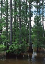 Baldcypress3.7 mi
 Westport HouseHeritage attraction · 3.7 mi
 InishdaughIslet · 5.6 mi
 InishimmelIslet · 5.6 mi
Pictures: National Inventory of Architectural Heritage; Robert Ashby, Geograph · Creative Commons Attribution-ShareAlike 2.0; Maker named on the Wikimedia Commons picture page · Public domain; Laurel Lodged, Wikimedia Commons · CC0; Colin Park, Geograph · CC BY-SA 2.0
More historic places in County Mayo · All of County Mayo
What do you know about this place?