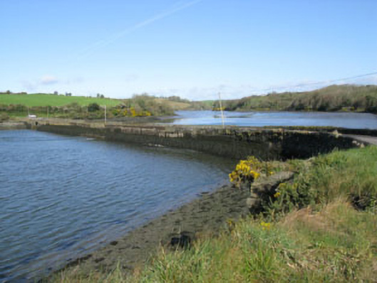
What is recorded here
Freestanding rubble stone causeway, built c.1820, spanning White Castle creek. Battered rubble stone and stone block walls with recent concrete repairs and iron bracing to eastern end. Square-headed arch to western end having concrete lintels and rendered soffit springing from stone block piers. Group of ten square-headed arches to eastern end having rendered surrounds, soffits and battered piers. Rubble stone parapet walls with recent concrete block repairs having rubble stone and recent rendered coping.
This substantial causeway is an integral part of the local transport and communication networks and is ideally situated at the last possible bridging point over the White Castle Creek estuary. Its well-constructed stone block walls have carried far more and heavier traffic than its original builders could have imagined. Curiously the causeway features two different types of bridges, firstly a large square-headed arch contrasting against a group of ten smaller square-headed arches.
From the Buildings of Ireland (National Inventory of Architectural Heritage) record 20911141
This does not grant access. Most recorded buildings are privately owned; view them only from public ground unless the owner allows entry.
Places near here
Photo credits
- National Inventory of Architectural Heritage
- Garry Dickinson, Geograph · CC BY-SA 2.0
- Unknown author Unknown author, Wikimedia Commons · Public domain
- ME, Wikimedia Commons · CC BY-SA 3.0
- The Speckled Bird, Wikimedia Commons · CC BY-SA 4.0
- David Dixon, Geograph · CC BY-SA 2.0
- Mike Searle, Geograph · CC BY-SA 2.0
- Einaz80, Wikimedia Commons · CC BY-SA 4.0
- Andy Beecroft, Wikimedia Commons · CC BY-SA 2.0
 Ballinacurra HouseCountry house · 1030 ydBlacks Brewery & DistilleryHeritage attraction · 1167 yd
 Cappagh HouseHouse · 1351 yd
 White Castle (in Ruins)House, fortified house · 1699 yd
 Battle of KinsaleMajor battlefield · 1713 yd
 Desmond CastleMuseum · 1.2 mi
 GaolCastle, tower house · 1.2 mi
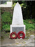 World War I MemorialMemorial · 1.5 mi
 James FortVisitor information · 1.7 mi
.jpg/250px-James_Fort_(Kinsale).jpg "Photo: Einaz80, Wikimedia Commons · CC BY-SA 4.0") Old FortBastioned fort · 1.8 mi
Old FortBastioned fort · 1.8 mi James' FortArchaeological place · 1.8 mi
 Sandy Cove IslandIslet · 2.4 mi
More historic places in County Cork · All of County Cork
What do you know about this place?