Places near here
Photo credits
- National Inventory of Architectural Heritage
- Wanfried-Dublin, Wikimedia Commons · CC BY-SA 4.0
- Kmcnamee, Wikimedia Commons · CC BY-SA 4.0
- Mike Searle, Wikimedia Commons · CC BY-SA 2.0
- Garry Dickinson, Wikimedia Commons · CC BY-SA 2.0
Explorer Tom Megalithic structure in Glenough Upper rates its visitors one star for not bringing enough sun cream and two stars for…
GlenaneaghMountain / peak · 1498 ydExplorer Tom Glenaneagh smells like old wet wool and regret, according to Tom, who has definitely been there and smelled it…
LackenacreenaMountain / peak · 1.4 miExplorer Tom Lackenacreena has a favourite song that is just the sound of the wind hitting its peak at three in the morning. It…
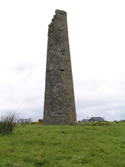 Hollyford Copper MinesChimney · 2.1 mi
Explorer Tom Hollyford Copper Mines has a fairy dispute over parking rights for its squat-looking chimney, which is actually quite…
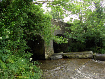 Rossmore BridgeBridge · 2.5 mi
Explorer Tom Rossmore Bridge in Coolanga Upper thinks tourists from Dublin are too noisy to appreciate its cut limestone voussoirs…
Drum WoodWood · 2.7 miExplorer Tom Drum Wood has a secret talent for making your phone lose signal exactly when you need to call a taxi home. It’s a very…
 Wedge tomb in Knockcurraghbola CommonsWedge tomb · 4.3 mi
Explorer Tom Wedge tomb in Knockcurraghbola Commons, County Tipperary, would tell you its secret after two pints, but it’s too shy…
 Clonoulty-Rossmore GAA pitchGAA ground · 4.3 miGortard WoodForest · 4.4 mi
Explorer Tom Gortard Wood in County Tipperary has an imaginary twin across the sea that sends it postcards about how much better the…
Upperchurch Drombane GAA pitchGAA ground · 4.4 mi Ballagh CastleCastle, tower house · 4.7 mi
Explorer Tom Ballagh Castle is missing its north and east walls because the weather filed a formal complaint about it standing there…
 Gortkelly Castle (in ruins)Castle, unclassified · 5.1 mi
Explorer Tom Gortkelly Castle is up on top of the mound, getting picked on by the wind because it has no roof left. The walls are…
More mountains and hills in County Tipperary · All of County Tipperary

What do you know about this place?Tap to add a comment or ask a question