
What is recorded here
From the National Monuments Service (Archaeological Survey of Ireland) record KK009-066003
Places near here
Photo credits
- A.-K. D., Wikimedia Commons · CC0
- A.-K. D., Wikimedia Commons · CC BY-SA 4.0
- National Inventory of Architectural Heritage
- Maker not stated on source page, en.topwar.ru
- Maker not stated on source page, www.interment.net
- Maker not stated on source page, commons.wikimedia.org
- kevin higgins, Wikimedia Commons · CC BY-SA 2.0
- Maker not stated on source page, www.tripadvisor.co.uk
- Maker not stated on source page, www.pinterest.com
 CastleCastle, unclassified · 295 yd
Explorer Tom Castle in Inchmore would give you two stars for visiting without proper boots. The Grace family owned it and probably…
 Bridge in InchmoreBridge · 375 yd
Explorer Tom Bridge in Inchmore thinks it’s the main event, but honestly, it’s just there to get from one side to the other without…
 Castle (in Ruins)Castle, tower house · 635 yd
Explorer Tom Castle in Lismaine got lost looking for the Vikings, who were actually just lost on their way to Dublin. Only a wall…
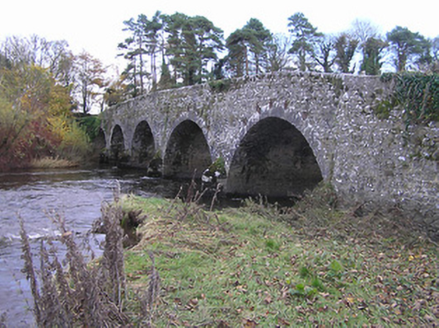 Lismaine BridgeBridge · 686 yd
Explorer Tom Lismaine Bridge would teach history by throwing rocks at you if the River Nore wasn’t in the way. It’s a big stone slab…
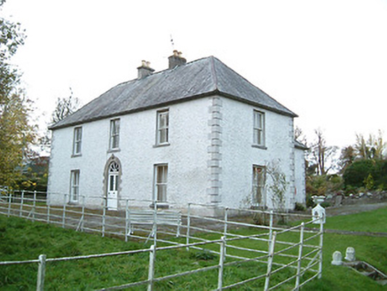 Lismaine HouseFarm house · 738 yd
Explorer Tom Lismaine House is just a farmhouse that accidentally became a classical masterpiece. It ended up in the wrong place…
 Enclosure in Clintstown (fassadinin By.)Enclosure · 1358 yd
Explorer Tom Enclosure in Clintstown makes a weird humming sound at night that might be wind or might be spirits arguing about…
 Graveyard in Clintstown (fassadinin By.)Graveyard · 1407 yd
Explorer Tom Graveyard in Clintstown hosted a dance that went too far, leaving some very tired ghosts behind to this day. It sits…
 Graveyard in Cooleeshal BegGraveyard · 1710 yd
Explorer Tom Graveyard in Cooleeshal Beg has a prophecy that it will one day float away on the Nuenna river, but so far it’s just…
 RathbeaghFairy fort / earthen ringfort · 1.0 mi
Explorer Tom Rathbeagh has an imaginary twin across the sea that probably drinks too much tea and complains about the weather. It’s…
 St. Catherines WellHoly well · 1.1 mi
Explorer Tom St. Catherines Well in Rathbeagh is locked in a permanent feud with the rain because it keeps getting flooded out of…
 TombTomb, chest tomb · 1.1 mi
Explorer Tom Tomb in Rathbeagh would describe itself as 'a bit of a mess' and 'still standing,' which is honestly all I can say for…
 Rathbeagh GraveyardGraveyard · 1.1 mi
Explorer Tom Rathbeagh Graveyard would order a massive portion of chips and gravy, plus a pint of stout for good measure. It thinks…
More archaeology and monuments in County Kilkenny · All of County Kilkenny

What do you know about this place?Tap to add a comment or ask a question