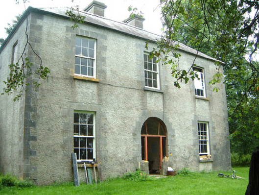
What is recorded here
Detached three-bay two-storey rendered house, built c. 1835. L-plan returning four-bays to west. Hipped slate roof, gabled to return, clay ridge and hip tiles, unpainted smooth-rendered corbelled chimneystacks, half-round cast-iron gutters on eaves corbel course. Unpainted roughcast walling, dressed ashlar limestone quoins. Square-headed window openings, block-and-start ashlar limestone surrounds, limestone sills, painted six-over-six timber sash windows replaced c. 2000, wrought-iron grilles to ground floor windows at west and north. Round-headed entrance door opening, block-and-start dressed ashlar limestone surround, plain-glazed fanlight arbitrarily sub-divided into three panes, sidelights on flush stone sills, painted timber panelled door c. 1990. Set back from road in own grounds, rubble stone outbuildings to north-west and west, single-storey sandstone rubble forge building to south-east, gardens to south and east with nature specimen trees, yard to west with tall rubble stone boundary wall, entrance lane to south-west, rubble stone boundary walls, dressed limestone gate piers, wrought-iron gates.
This fine hunting lodge displays elegant balanced proportions and retains a variety of original and early outbuildings as well as well-preserved grounds. An earlier forge on the site may be of archaeological interest.
From the Buildings of Ireland (National Inventory of Architectural Heritage) record 32404401
This does not grant access. Most recorded buildings are privately owned; view them only from public ground unless the owner allows entry.
Places near here
IndicatedFairy fort / stone ringfort · 895 yd Moygara Castle (in Ruins)Bawn · 1430 ydMoygara CastleCastle · 1433 ydCrow IslandIslet · 1.9 miGorteen Church (Kilfree)Church/chapel · 2.0 miSaint Patrick's Catholic ChurchChurch/chapel · 2.3 miInch IslandIslet · 2.5 miCastle PointHeadland · 2.6 miRose PointHeadland · 3.4 miCurlew MountainsMountain / peak · 3.4 miToberaraghtHoly well · 3.5 miCarricknahorna EastMountain / peak · 5.8 mi
_-_geograph.org.uk_-_4073636.jpg/250px-Castles_of_Connacht,_Moygara,_Sligo_(2)_-_geograph.org.uk_-_4073636.jpg "Photo: Mike Searle, Wikimedia Commons · CC BY-SA 2.0") Moygara Castle (in Ruins)Bawn · 1430 yd
Moygara Castle (in Ruins)Bawn · 1430 yd_-_geograph.org.uk_-_4073628.jpg/250px-Castles_of_Connacht,_Moygara,_Sligo_(1)_-_geograph.org.uk_-_4073628.jpg "Photo: Mike Searle, Wikimedia Commons · CC BY-SA 2.0") Moygara CastleCastle · 1433 ydCrow IslandIslet · 1.9 mi
Moygara CastleCastle · 1433 ydCrow IslandIslet · 1.9 mi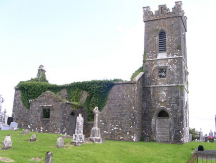 Gorteen Church (Kilfree)Church/chapel · 2.0 mi
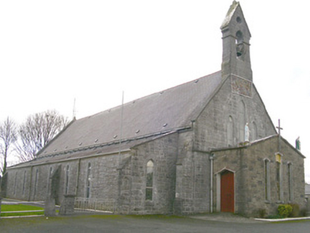 Saint Patrick's Catholic ChurchChurch/chapel · 2.3 miInch IslandIslet · 2.5 miCastle PointHeadland · 2.6 miRose PointHeadland · 3.4 mi
 Curlew MountainsMountain / peak · 3.4 mi
 ToberaraghtHoly well · 3.5 miCarricknahorna EastMountain / peak · 5.8 mi
Pictures: Mike Searle, Wikimedia Commons · CC BY-SA 2.0; National Inventory of Architectural Heritage; Wikimedia Commons contributor · CC BY 2.5; Aiden Clarke, Wikimedia Commons · CC BY-SA 2.0
More historic places in County Sligo · All of County Sligo
What do you know about this place?