What is recorded here
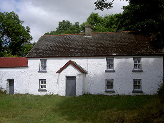
Detached four-bay two-storey house, built c. 1820. Projecting gabled porch to south (front) elevation, single-storey curved corrugated-iron-roofed outbuilding abutting west gable, single-storey corrugated-iron-roofed lean-to shed abutting west gable of outbuilding. Pitched artificial slate roof, terracotta ridge tiles, unpainted smooth rendered corbelled chimneystack; painted timber soffits, fascias and bargeboards c. 1950; cast-iron gutters to rear (north) elevation and outbuilding. Lime-washed rendered walling with rubble stonework visible in places and evidence on west gable that roof raised c. 1950, structural ties to west of south elevation and to outbuilding. Square-headed window openings, painted smooth rendered reveals and soffits, painted stone sills, painted timber two-over-two horned sliding sash windows. Square-headed door opening in porch, painted timber vertically-sheeted door. Range of outbuildings to roadside to south-west of house, corrugated-iron roof, rubble stone walling, raised verges to east gable, loop windows splayed internally, square-headed door openings, elliptical-headed brick-dressed carriage arch to east gable; bounded to south and east by rubble wall; farm land to north and west; set back from crossroads to south.
This house, built in the vernacular tradition, had its roof raised at some point during the twentieth century and the original masonry walls were stabilised with wrought-iron ties. The superior quality construction of the roadside outbuilding hints at the varying prosperity of the farming community at various times and the whole site is an excellent example of the gentle evolution which is so typical of vernacular construction.
This does not grant access. Most recorded buildings are privately owned; view them only from public ground unless the owner allows entry.
Places near here
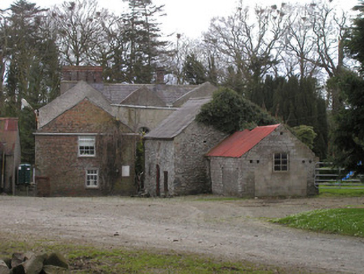 Togher Househouse · 221 yd
 IndicatedCastle, tower house · 586 yd
 Church (in Ruins)Church · 759 yd
 Enclosure in Nicholastown (ferrard By.)Enclosure · 1.1 mi
 Enclosure in MartinstownEnclosure · 1.2 mi
 Graveyard in DysartGraveyard · 1.3 mi
 Moneyveg WoodForest · 1.6 mi
 BarmeathCastle, tower house · 1.6 mi
 Sweet baySweet bay · 1.6 mi
 Tullydonnell HillMountain / peak · 1.7 mi
 Chapel (in Ruins), GraveyardChurch · 2.5 mi
 Drummeenagh HillMountain / peak · 5.9 mi
Other information
Photo: National Inventory of Architectural Heritage · Website use allowed for educational or private purposes with source credit