What is recorded here
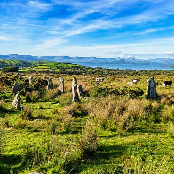
One chamber in Ardgroom Outward still stands beside two burnt mounds, its stone leaning slightly as if listening across centuries. People may have gathered there to mark loss, celebrate birth or argue the shape of heaven. The mountain gives no answer, but it keeps the place alive.
In rough hill pasture, on the lower N-facing slopes of Tooreennamna Mountain. This standing stone (1.79m x 0.64m; H 1.13m) is orientated NNE-SSW. The upper portion of the stone slopes down to the NNE. Two burnt mounds (CO102-041007-, CO102-041013-) are c. 50m to the NW.
The above description is derived from 'The Archaeological Inventory of County Cork. Volume 5' (Dublin: Stationery Office, 2009).
Date of upload: 22 December 2009
The monument record does not grant public access. Check the route and ask the landowner before entering private land.
- What survives
- Recorded monument
Places near here
 CairnCairn, unclassified · 236 yd
 Field boundary in Ardgroom OutwardField boundary · 397 yd
 CoomacloghaneMountain / peak · 1718 yd
 Glashananinnaun Br.Bridge · 1740 yd
 Keeragh MountainMountain / peak · 1.4 mi
 Bird IslandIslet · 1.5 mi
 Cappul Bridgebridge · 1.7 mi
 Ardgroom Pulleen LoopWalking route · 2.2 mi
 Crane IslandIslet · 3.5 mi
 Beara WayWalking route · 3.6 mi
 Japanese cedarJapanese cedar · 4.0 mi
 Soft Tree-fernSoft Tree-fern · 4.0 mi