What is recorded here
Fairy fort / earthen ringfort in Rochfort Demesne is a fairy fort or earthen ringfort in Rochfort Demesne, County Westmeath, Ireland. The 1913 edition of the Ordnance Survey 25-inch map depicts the site as an oval-shaped earthwork defined by a scarp, with dimensions of approximately 49 metres north-east to south-west and 34 metres north-west to south-east. The site is currently represented by a scatter of earth that is more stony than the surrounding soil, where the most stony ground forms a ring around the perimeter and the interior is smoother.
Situated on top of a steep hillock, in tillage, surrounded by undulating pasture with good views in all directions, Lough Ennell visible to W. Annotated ‘Fort’ on the 1837 OS Fair Plan map and depicted as a circular-shaped tree-planted earthwork defined by a scarp. Depicted on the revised 1913 ed. OS 25-inch map as an oval-shaped earthwork (approx. dims. 49m NE-SW; 34m NW-SE) defined by a scarp. Monument described in 1971 as no surface remains visible. The site is represented by a scatter (overall dims. 56m ENE-WSW and 43m NNW-SSE) of earth which is more stony in contrast to the soil around it. There are indications that the earthwork was an enclosure as the most stony soil forms a ring around the perimeter and the ground inside it is smoother and less stony. The site would be suitable for a ringfort. Monument is visible on Digital Globe aerial photography as the cropmark of an oval-shaped earthwork.
Compiled by Alison McQueen, Vera Rahilly and Caimin O’Brien.
Date of upload: 02 October 2019
A fairy fort or earthen ringfort in Rochfort Demesne, likely dating to the early medieval period, is situated on a prominent hillock and was marked as a 'Fort' on the 1837 OS Fair Plan. Local tradition associates such sites with fairy folklore, and they were often avoided due to beliefs in supernatural inhabitants.
The monument record does not grant public access. Check the route and ask the landowner before entering private land.
- What survives
- Recorded monument
Places near here
 Hachured, RahaclowineFairy fort / earthen ringfort · 356 yd
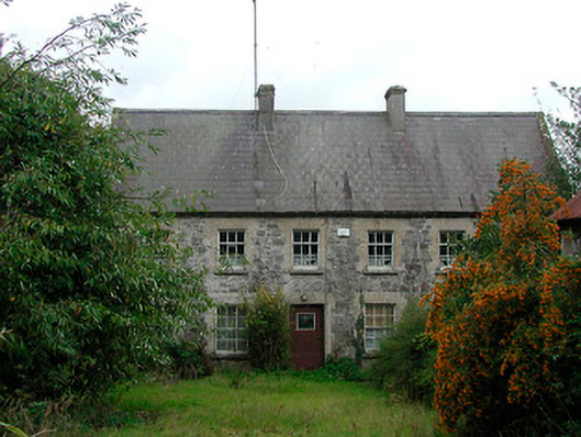 Rochfort Millmiller's house · 438 yd
 Carrick Lodgefarm house · 506 yd
 Mollie Moo's Pet FarmHeritage attraction · 587 yd
 CastleCastle, unclassified · 1054 yd
 Belvedere house and gardensVisitor information · 1154 yd
 Enclosure in Carrick (fartullagh By.)Enclosure · 1265 yd
 Blind IslandIslet · 1.0 mi
 Castle in RuinsCastle, tower house · 1.3 mi
 Dysart IslandIsland · 2.0 mi
 United Nations War MemorialMemorial · 5.0 mi
 WestmeathVisitor information · 6.3 mi