
What is recorded here
Situated on a broad NW-SE spur. Subcircular scrub-covered area (dims. 57m E-W; c. 50m N-S) defined by an overgrown earth and stone bank (Wth 5m; int. H 1-1.2m; ext. H 1.5m), which has been removed S-W. An outer, slightly flat-bottomed fosse (Wth of top 6.5-7.5m; Wth of base 2.5m at N to 4m at E; ext. D 0.8m at N to - 1.3m at E) survives complete, with an external stone-faced bank (Wth c. 2m; ext. H c. 0.5m) incorporated into a field bank NE-S. The entrance (Wth 3m) at SE has been widened.
The above description is derived from the published 'Archaeological Inventory of County Waterford' (Dublin: Stationery Office, 1999). In certain instances the entries have been revised and updated in the light of recent research.
Compiled by: Michael Moore
Date of upload: 01 November 2010
This remains an important historical record, but the official description says the monument is no longer visible or has been destroyed. The monument record does not grant public access. Check the route and ask the landowner before entering private land.
- What survives
- No visible remains or recorded as destroyed
Places near here
 Fulacht fia in BoolabegFulacht fia · 1044 yd
 Water millWater mill, horizontal-wheeled · 1698 yd
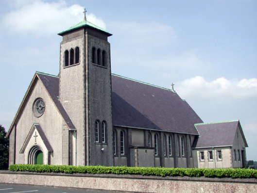 Catholic Church of the Sacred Heart of Jesuschurch/chapel · 1.4 mi
 Burnt mound in KilbrackBurnt mound · 1.4 mi
 MoteCastle, motte and bailey · 1.7 mi
 Feddans CastleRuins · 1.8 mi
 Curraheen TrailsVisitor information · 1.8 mi
 The Boolas LoopWalking route · 1.8 mi
 The Boolas Linear TrailWalking route · 1.9 mi
 LackaduffMountain / peak · 2.1 mi
 StookanmeenMountain / peak · 2.4 mi
 CoumshingaunMountain corrie and lake · 2.7 mi
Other information
Photo: Credit not shown in the picture search · Rights wording not checked; contact us if this picture should be removed