
What is recorded here
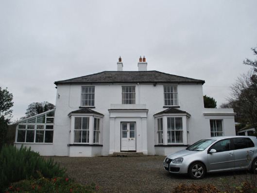
Detached four-bay single-storey groundskeeper's house, occupied 1901, on a T-shaped plan off-centred on single-bay single-storey gabled projecting lower porch. "Refurbished", 2002. Pitched slate roof on a T-shaped plan extending into hipped slate roof abutting pitched (gabled) slate roof (porch), clay ridge tiles, rendered chimney stacks having concrete capping supporting terracotta pots, timber bargeboards to gables on timber spandrels, and cast-iron rainwater goods on timber eaves boards on exposed timber rafters retaining cast-iron octagonal or ogee hoppers and downpipes. Roughcast walls on rendered plinth with "timber frame" surface finish to gables. Square-headed off-central door opening with step threshold, and timber surround having bull nose-detailed reveals framing glazed timber panelled double doors. Square-headed flanking window openings with cut-granite sills, and concealed dressings framing timber casement windows. Set in landscaped grounds shared with Saint Tiernan's Church (Kiltiernan).
A groundskeeper's house representing an integral component of the late nineteenth-century built heritage of south County Dublin with the architectural value of the composition, one most likely repurposing an earlier house displaying an abbreviated footprint on the first edition of the Ordnance Survey (surveyed 1837; published 1843), suggested by such attributes as the compact plan form off-centred on an expressed porch; the definition of the principal "apartment" by a semi-polygonal bay window; and the Arts and Crafts-like timber work embellishing the roofline. Having been well maintained, the elementary form and massing survive intact together with substantial quantities of the original fabric, both to the exterior and to the interior, thus upholding the character or integrity of a groundskeeper's house forming part of a neat self-contained group alongside the adjacent Saint Tiernan's Church (Kiltiernan) (see 60260011) and school house (see 60260012) with the resulting ensemble making a pleasing visual statement in a sylvan street scene.
This does not grant access. Most recorded buildings are privately owned; view them only from public ground unless the owner allows entry.
Places near here
 Saint Tiernan's Church (Kiltiernan)school · 17 yd
 Firmounthouse · 61 yd
 Ring-ditch in Glenamuck NorthRing-ditch · 197 yd
 Fulacht fia in Glenamuck NorthFulacht fia · 219 yd
 Dingle GlenNature reserve · 1641 yd
 Bawn in Carrickmines GreatBawn · 1.2 mi
 Ballybetagh WoodForest · 1.3 mi
 Three Rock MountainMountain / peak · 1.5 mi
 Murphystown Castle (in ruins)Castle, tower house · 1.6 mi
 Foxrock VillageVisitor information · 1.7 mi
 Foxrock Village Heritage MapVisitor information · 1.7 mi
 Flat cemetery in CarmanhallFlat cemetery · 1.7 mi
Other information
Photo: National Inventory of Architectural Heritage · Website use allowed for educational or private purposes with source credit