What is recorded here
Gallaun is a tall standing stone in Glanleam, County Kerry, trapped inside a much younger fort called Cromwell's Fort. The prehistoric upright predates the military earthwork by millennia, creating a strange layered collision where ancient belief meets later conquest. A leaning slab now braces its base after visitor Chatterton recorded in 1839 that the stone shook easily, proving human hands have long fought to keep its shadow steady against the sky.
In rough grazing, on E-facing slope. Stone (H 1.3m; 0.8m x 0.25m) is subrectangular in plan, long axis NE-SW.
The above description is derived from the published 'Archaeological Inventory of County Cork. Volume 3: Mid Cork' (Dublin: Stationery Office, 1997). In certain instances the entries have been revised and updated in the light of recent research.
Date of upload/revision: 14 January 2009
Likely dating to the Neolithic or Early Bronze Age, this standing stone may have functioned as a territorial marker or ceremonial feature. No specific folklore or detailed use is recorded for Gallaun, An Screathan Mór.
The monument record does not grant public access. Check the route and ask the landowner before entering private land.
- What survives
- Recorded monument
Places near here
 Giants GraveWedge tomb · 1344 yd
 Wedge tomb in Céim ChorrbhuaileWedge tomb · 1413 yd
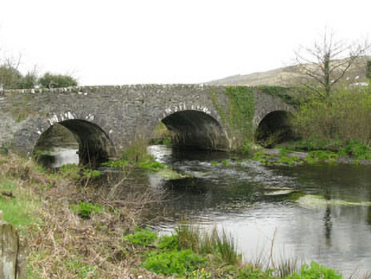 Inchinossig Bridgebridge · 1.6 mi
 Stepping StonesClapper bridge · 1.7 mi
 Gougane BarraValley and heritage place · 2.2 mi
 European ashEuropean ash · 2.3 mi
 MweelinMountain / peak · 2.4 mi
 Doughill MountainMountain / peak · 3.0 mi
 Sli Gaeltacht MuscraiWalking route · 3.8 mi
 European long distance path E8 - part IrelandWalking route · 5.8 mi
 Gortnahoughtee Mass RockNamed rock · 6.1 mi
 CastleCastle, unclassified · 6.2 mi