What is recorded here
Two shallow ditches cut northwest to southeast through Rath-Healy, holding dark-brown sandy silt and waiting beneath the future N8 Rathcormac-Fermoy bypass. One had a flat base, the other a rounded bottom, like two different hands drawing a line across the same field. They may date from after 1700, when people still shaped land with shovels rather than surveying wheels. The road nearly erased them, but measurement gave back what forgetting would have taken.
Discovered in 2002 and subsequently excavated in 2003 in advance of the construction of the N8 Rathcormac-Fermoy bypass (Murphy 2006g, 72-3; 2006n). Excavation revealed two field boundary ditches which were orientated NW-SE and consisted of a compact dark-brown sandy silt with occasional stones. The first boundary ditch (Wth 2m; D 0.2m) had a flat base while the second one (Wth 1.2m; D 0.42m) had a rounded base. A number of excavated features (CO035-139----) in the immediate vicinity were also excavated. In the absence of dateable evidence for these field boundaries, it is considered that they probably post-1700 in date. (Murphy 2006g, 72-3; 2006n)
Compiled by: Archaeological Survey Unit, UCC.
Date of upload: 20 Jan. 2010
The monument record does not grant public access. Check the route and ask the landowner before entering private land.
- What survives
- Recorded monument
Places near here
 KilnKiln, corn-drying · 129 yd
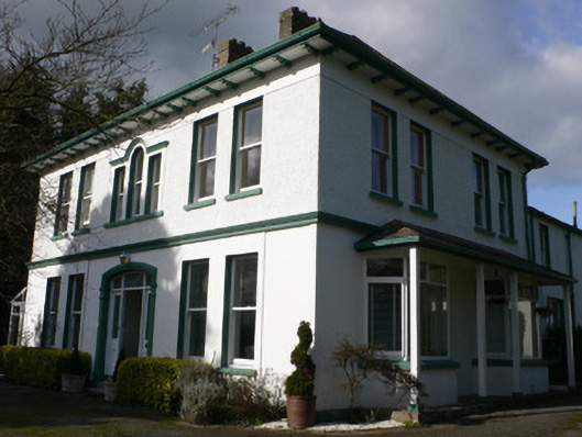 Tullagreine Househouse · 534 yd
 Burial GroundGraveyard · 548 yd
 TumulusBarrow, mound barrow · 852 yd
 Old Railway ViaductViewpoint · 909 yd
 Carrigabrick Castle (in Ruins)Castle, tower house · 979 yd
 Licklash Castle (in Ruins)Castle, hall-house · 1148 yd
 Kent BridgeMemorial · 1405 yd
 Tourist InformationVisitor information · 1450 yd
 Graveyard in FermoyGraveyard · 1557 yd
 Ballybrack WoodForest · 1.8 mi
 Strawhall WoodForest · 1.9 mi