What is recorded here
Meadow grass and forgotten time have swallowed the fort, leaving only a shallow circular scar on the hillside. Yet the earth still holds the shape of human intention, a temporary boundary drawn against the infinite dark. The fairies never lived there; they merely inherited the loneliness. What humans built, they completed by forgetting it.
Located on the NE-facing slope of a hill. This is a grass-covered circular area (int. diam. 24.5m N-S; 24m E-W) defined by a round-topped and overgrown, steep-sided earthen bank (at W: Wth 4.45m; int. H 0.9m; ext. H 1.1m) S-W-N, which is reduced to a scarp elsewhere and which is separated by a fosse (at W: Wth of base 4.15; D 0.75m) from an outer bank (at W: Wth 3.4m; H 0.1m) SW-N. The original entrance is not identified visually. Rath (LE027-066----) is c. 25m to the SW.
A magnetic gradiometry survey in the vicinity of both raths produced mixed results with much modern disturbance that is likely to be ploughing and drainage evident. However, a number of features that could be pits or natural hollows were also recorded N of (LE027-067----). Running NE from (LE027-066---) two arcs of positive anomalies c. 5m apart appear to be leading to the SW quadrant of (LE027-067----), perhaps as a causeway with ditches at either side. An earth resistance survey along the E side of this rath can confirm the presence of a bank and outer fosse here, but there is no evidence of an external bank on this side. High resistance anomalies in the interior suggest that whatever features are present have a large stone component, although no pattern could be discerned. A line of high resistance anomalies across the bank and ditch at SE hints at the possibility of an entrance here. (Curran 2015, 8-9)
The above description is derived from 'The Archaeological Inventory of County Leitrim' compiled by Michael J. Moore (Dublin: Stationery Office, 2003). In certain instances the entries have been revised and updated in the light of recent research.
Date of revised upload: 8 June 2018
The monument record does not grant public access. Check the route and ask the landowner before entering private land.
- What survives
- Recorded monument
Places near here
 Fairy fort / earthen ringfort in PortFairy fort / earthen ringfort · 77 yd
 PortCastle, unclassified · 486 yd
 Enclosure in CarrickevyEnclosure · 571 yd
 AbbeyChurch · 959 yd
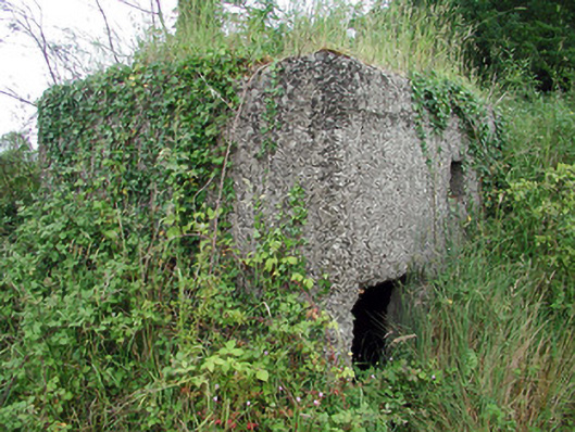 pill boxpill box · 1251 yd
 Sit of Breifny CastleCastle, tower house · 1438 yd
 Shannon-Erne WaterwayVisitor information · 1463 yd
 Battle of Áth an Chipbattle · 1.3 mi
 Leabaidh DermotCave · 2.3 mi
 InishnagonIsland · 2.3 mi
 Sheemore Ambush MemorialMonument · 2.6 mi
 Moon RiverHeritage attraction · 2.8 mi