
What is recorded here
Scrub hides the causeways still, but the earth remembers the shape of bodies that crossed them. The fort stands at the crest of a hill in Port, County Leitrim, its dual banks and narrow gaps waiting for footsteps that time has forgotten.
Located at the crest of the NE-facing slope of a hill. This is a scrub-covered subcircular area (int. dims 37m N-S; 31m E-W) defined by an overgrown, round-topped, steep-sided earthen bank (at N: Wth 2.9m; int. H 0.4m; ext. H 0.9-1.95m) which is separated by a fosse (at N: Wth of base 2.8m; ext. D 1.2m) from an outer bank (at N: Wth 4.5m; H 1.1m). There are entrances through both banks with causeways at E (Wth 1.5m) and at SE (Wth 2.1m). The monument is circumscribed by a field bank at E and there is a record of the discovery of a Man-made underground passage near it in the 1930s (Blaney 1944, file no. 143). Rath (LE027-067----) is c. 25m to the NE.
A magnetic gradiometry survey in the vicinity of both raths produced mixed results with much modern disturbance that is likely to be ploughing and drainage evident. However, running NE from this rath two arcs of positive anomalies c. 5m apart, perhaps as a stone-faced causeway, appear to be leading to the SW quadrant of (LE027-067----). The interior of this rath produced a number of high resistance anomalies, suggesting the presence of a large amount of stone, but no patterns were discernible. (Curran 2015, 8,9)
The above description is derived from 'The Archaeological Inventory of County Leitrim' compiled by Michael J. Moore (Dublin: Stationery Office, 2003). In certain instances the entries have been revised and updated in the light of recent research.
Date of revised upload: 8 June 2018
The monument record does not grant public access. Check the route and ask the landowner before entering private land.
- What survives
- Recorded monument
Places near here
 PortCastle, unclassified · 430 yd
 Enclosure in CorhawnaghEnclosure · 533 yd
 Enclosure in CarrickevyEnclosure · 644 yd
 AbbeyChurch · 941 yd
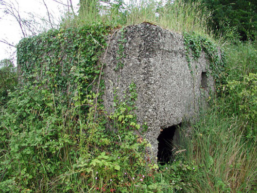 pill boxpill box · 1300 yd
 Sit of Breifny CastleCastle, tower house · 1485 yd
 Shannon-Erne WaterwayVisitor information · 1511 yd
 Battle of Áth an Chipbattle · 1.3 mi
 Leabaidh DermotCave · 2.3 mi
 InishnagonIsland · 2.3 mi
 Sheemore Ambush MemorialMonument · 2.6 mi
 Moon RiverHeritage attraction · 2.7 mi
Other information
Photo: Credit not shown in the picture search · Rights wording not checked; contact us if this picture should be removed